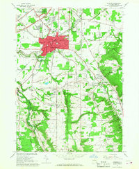
1965 Map of Hamburg
USGS Topo · Published 1968About this map
Hamburg stands as a bustling hub in the mid-1960s, defined by the expansion of residential blocks and key community infrastructure like the Erie County Fairgrounds and the SS Peter and Paul Sch. The landscape is carved by the deep valley of Eighteenmile Creek, which separates the concentrated development of the village from the rural reaches of East Eden and North Boston. The era's transportation shifts are evident in the presence of Interchange 57 on the Thruway, contrasting with the older corridors of the Erie-Lackawanna railroad.
Find a feature on this map
84 named features on this map. Tap any name to fly to it.
Don’t see what you’re looking for? This feature index may not catch every label — zoom into the map to look around manually.
Map Details
Editions of this 1965 Hamburg Map
3 editions found
Other maps of this area

1894 · Buffalo
USGS Topo · 1:62,500

1901 · Buffalo
USGS Topo · 1:62,500

1905 · Depew
USGS Topo · 1:62,500

1905 · Eden
USGS Topo · 1:62,500

1907 · Eden
USGS Topo · 1:62,500

1925 · Springville
USGS Topo · 1:62,500

1944 · Eden
USGS Topo · 1:62,500

1944 · North Collins
USGS Topo · 1:31,680

1944 · Hamburg
USGS Topo · 1:31,680

1944 · Langford
USGS Topo · 1:31,680