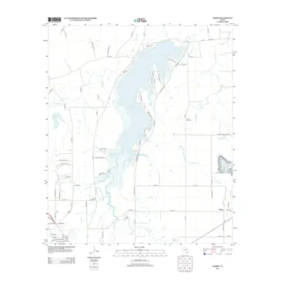
2012 Map of Hamby
USGS Topo · Published 2012About this map
Lake Fort Phantom Hill dominates the central geography of this Taylor County landscape, its irregular shoreline defined by numerous residential coves and points such as Arrow Pt and Poverty Point Cir. This 2012 survey illustrates the modern interface between the reservoir's recreational developments and the rural heritage of the surrounding plains. To the east of the lake, the Round Mound Cem serves as a quiet marker of local genealogy near the winding course of Deadman Cr. The map details the transition from the small community of Hamby in the southeast toward the northern reaches of Abilene. A complex network of drainage basins, including the Clear Fork, Elm Cr, and Mulberry Cr, converge here, feeding into the reservoir system that sustains the region's water needs while shaping the layout of local county roads and farm-to-market routes.
Find a feature on this map
80 named features on this map. Tap any name to fly to it.
Don’t see what you’re looking for? This feature index may not catch every label — zoom into the map to look around manually.
Map Details
Editions of this 2012 Hamby Map
This is the sole edition of this map. No revisions or reprints were ever made.
Other maps of this area

1890 · Abilene
USGS Topo · 1:125,000

1891 · Anson
USGS Topo · 1:125,000

1892 · Abilene
USGS Topo · 1:125,000

1893 · Anson
USGS Topo · 1:125,000

1954 · Abilene
USGS Topo · 1:250,000

1957 · Hawley
USGS Topo · 1:62,500

1957 · Kirby Lake
USGS Topo · 1:62,500

1957 · Abilene West
USGS Topo · 1:24,000

1957 · Abilene East
USGS Topo · 1:24,000

1957 · Nugent
USGS Topo · 1:62,500