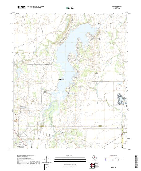
2022 Map of Hamby
USGS Topo · Published 2022About this map
Lake Fort Phantom Hill dominates this Jones County landscape, north of the city limits of Abilene. This modern survey illustrates the convergence of several major water systems, including the Clear Fork Brazos River and Elm Creek. The shoreline of the reservoir is marked by residential and recreational features like Cheyenne Cove and Poverty Point Cir. To the southwest, the Texas State Veteran's Cem at Abilene stands as a significant commemorative landmark near the junction of local farm roads. Outside the urban expansion of Abilene, the area maintains its rural character through established settlements like Hamby and the town of Impact. Land use in the south is further defined by the Dodson Training Comp, while the northeast preserves local history at the Round Mound Cem near Deadman Creek.
Find a feature on this map
89 named features on this map. Tap any name to fly to it.
Don’t see what you’re looking for? This feature index may not catch every label — zoom into the map to look around manually.
Map Details
Editions of this 2022 Hamby Map
This is the sole edition of this map. No revisions or reprints were ever made.
Other maps of this area

1890 · Abilene
USGS Topo · 1:125,000

1891 · Anson
USGS Topo · 1:125,000

1892 · Abilene
USGS Topo · 1:125,000

1893 · Anson
USGS Topo · 1:125,000

1954 · Abilene
USGS Topo · 1:250,000

1957 · Hawley
USGS Topo · 1:62,500

1957 · Kirby Lake
USGS Topo · 1:62,500

1957 · Abilene West
USGS Topo · 1:24,000

1957 · Abilene East
USGS Topo · 1:24,000

1957 · Nugent
USGS Topo · 1:62,500