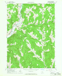
1965 Map of Hamden
USGS Topo · Published 1967About this map
The West Branch Delaware River carves a deep valley through this portion of Delaware County, serving as the primary corridor for settlement and transit. The hamlets of De Lancey and Hamden are situated along this waterway, where the flat valley floor contrasts sharply with the surrounding steep terrain of Hamden Hill and Scotch Mountain. The landscape is defined by a dense network of “cloves” and “hollows,” such as Terry Clove and Arbuckle Hollow, reflecting a traditional Appalachian drainage pattern where small agricultural clearings and family-named landmarks are tucked between high ridges like the Devils Backbone.
Find a feature on this map
38 named features on this map. Tap any name to fly to it.
Don’t see what you’re looking for? This feature index may not catch every label — zoom into the map to look around manually.
Map Details
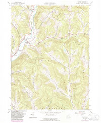
Editions of this 1965 Hamden Map
2 editions found
Other maps of this area

1909 · Delhi
USGS Topo · 1:62,500

1911 · Delhi
USGS Topo · 1:62,500

1915 · Oneonta
USGS Topo · 1:62,500

1918 · Oneonta
USGS Topo · 1:62,500

1922 · Andes
USGS Topo · 1:62,500

1923 · Walton
USGS Topo · 1:48,000

1924 · Andes
USGS Topo · 1:62,500

1925 · Walton
USGS Topo · 1:62,500

1943 · Delhi
USGS Topo · 1:24,000

1943 · Bloomville
USGS Topo · 1:24,000