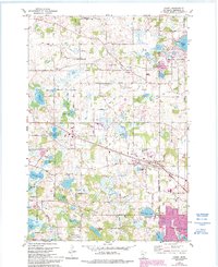
1981 Map of Hamel
USGS Topo · Published 1993About this map
Corcoran and Medina are central to this landscape in the early 1980s, revealing a rural character that was rapidly transitioning toward suburban development. The area is defined by its numerous water bodies, including Weaver Lake and Holy Name Lake, which provided recreation and drainage for the surrounding farms and growing residential tracts. Significant genealogical resources are documented throughout the township, such as the Old St Thomas Cem, St Janes Cem, and the Holy Name Cem near Holy Name Ch.
Find a feature on this map
68 named features on this map. Tap any name to fly to it.
Don’t see what you’re looking for? This feature index may not catch every label — zoom into the map to look around manually.
Map Details
Editions of this 1981 Hamel Map
2 editions found
Other maps of this area

1896 · Minneapolis
USGS Topo · 1:62,500

1901 · Minneapolis
USGS Topo · 1:62,500

1902 · Anoka
USGS Topo · 1:62,500

1905 · Minnetonka
USGS Topo · 1:62,500

1907 · Minnetonka
USGS Topo · 1:62,500

1909 · Rockford
USGS Topo · 1:62,500

1953 · Saint Paul
USGS Topo · 1:250,000

1953 · Stillwater
USGS Topo · 1:250,000

1954 · Hopkins
USGS Topo · 1:24,000

1954 · Minneapolis
USGS Topo · 1:62,500