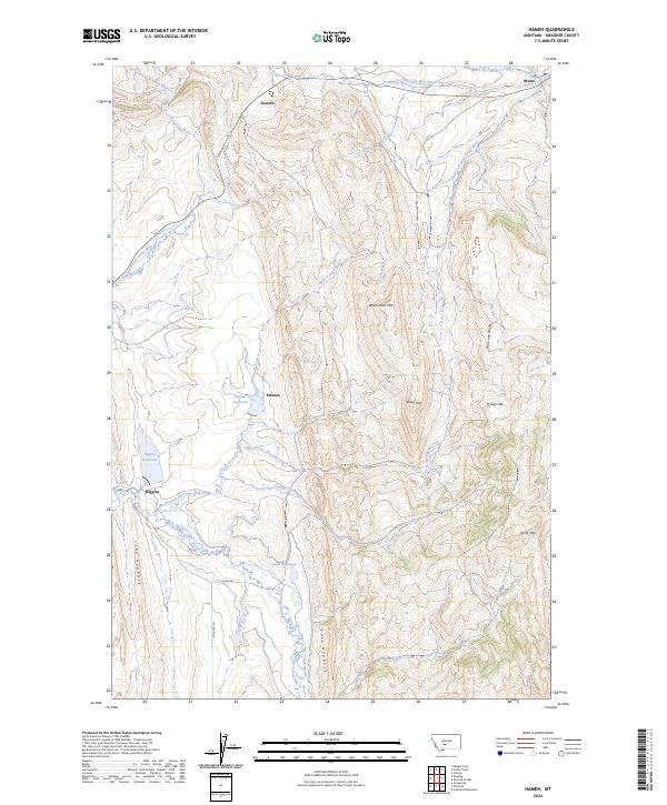
2024 Map of Hamen
USGS Topo · Published 2024About this map
Loweth and Bruno anchor the northern reaches of this Meagher County landscape, where the continental divide's influence dictates the flow of local waterways. This 2024 survey documents a critical drainage divide where the headwaters of the South Fork Smith River diverge from the Dry Fork Musselshell River and South Fork Musselshell River. The map illustrates a high-altitude ranching and watershed environment, marked by significant water management features like the Hamen Reservoir, Higgins Reservoir, and Lucas Reservoir. These reservoirs, connected by seasonal and perennial flows such as Woodson Creek and Sixteenmile Creek, support the scattered settlements in this high-country terrain.
Find a feature on this map
28 named features on this map. Tap any name to fly to it.
Don’t see what you’re looking for? This feature index may not catch every label — zoom into the map to look around manually.
Map Details
Editions of this 2024 Hamen Map
This is the sole edition of this map. No revisions or reprints were ever made.
Other maps of this area

1886 · Little Belt Mts.
USGS Topo · 1:250,000

1894 · Little Belt Mts.
USGS Topo · 1:250,000

1897 · Little Belt Mts.
USGS Topo · 1:250,000

1898 · Little Belt Mts.
USGS Topo · 1:250,000

1902 · Little Belt Mts.
USGS Topo · 1:250,000

1948 · White Sulphur Springs
USGS Topo · 1:250,000

1951 · Sixteen NE
USGS Topo · 1:24,000

1951 · Hamen
USGS Topo · 1:24,000
1951 · Wolf Hill
USGS Topo · 1:24,000
1951 · Ringling
USGS Topo · 1:24,000