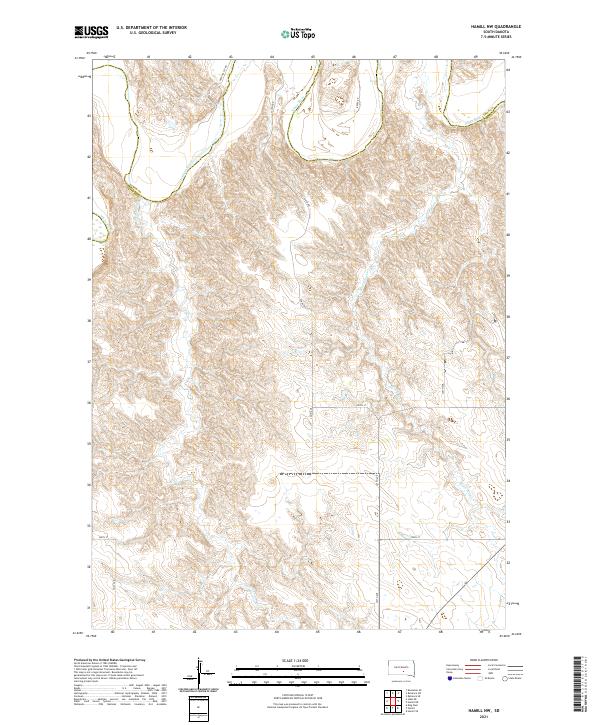
2021 Map of Hamill NW
USGS Topo · Published 2021About this map
White River carves a sweeping path across the northern boundary of this South Dakota landscape, defining the jagged border shared between Lyman Co and Tripp Co. The terrain is characterized by a dense network of coulees and ridges that drain toward the main river valley via No Moccasin Cr and Black Dog Cr. This 2021 survey illustrates a sparse, rural infrastructure where the section lines of the Public Land Survey System dictate the placement of local thoroughfares like 324th Ave and 259th St. The transition from the high prairie down to the river bottoms is marked by steep elevation changes, preserved here in a snapshot of modern ranching country. Local transit is served by a grid of named routes including Deer Valley Rd and Brule Rd, which navigate the undulating topography of the northern Great Plains.
Find a feature on this map
16 named features on this map. Tap any name to fly to it.
Don’t see what you’re looking for? This feature index may not catch every label — zoom into the map to look around manually.
Map Details
Editions of this 2021 Hamill NW Map
This is the sole edition of this map. No revisions or reprints were ever made.
Other maps of this area

1951 · Ideal NE
USGS Topo · 1:24,000

1952 · Reliance SW
USGS Topo · 1:24,000

1952 · Reliance SE
USGS Topo · 1:24,000

1952 · Hamill NW
USGS Topo · 1:24,000

1952 · Hamill NE
USGS Topo · 1:24,000

1955 · Mitchell
USGS Topo · 1:250,000

1959 · Mitchell
USGS Topo · 1:250,000

1971 · Hamill SE
USGS Topo · 1:24,000

1971 · Hamill
USGS Topo · 1:24,000
1978 · Kennebec SE
USGS Topo · 1:24,000