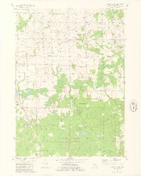
1981 Map of Hamilton East
USGS Topo · Published 1981About this map
Diamond Springs and Bentheim anchor a landscape defined by the transition from rural agricultural plots to the expansive woodlands of the Allegan State Game Area. The northern half of the sheet shows a dense grid of section roads like 142d Avenue, interspersed with local landmarks like Oakland Ch and the Busscher Landing Strip. The southern reaches are dominated by conservation land and natural drainage, where Silver Creek and Miller Creek feed into the Rabbit River.
Find a feature on this map
52 named features on this map. Tap any name to fly to it.
Don’t see what you’re looking for? This feature index may not catch every label — zoom into the map to look around manually.
Map Details
Editions of this 1981 Hamilton East Map
2 editions found
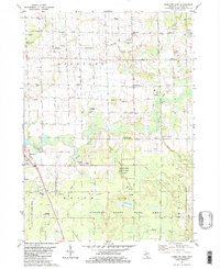
Other maps of this area

1928 · Fennville
USGS Topo · 1:62,500

1929 · Holland
USGS Topo · 1:62,500

1931 · Fennville
USGS Topo · 1:62,500

1932 · Holland
USGS Topo · 1:62,500

1958 · Allegan
USGS Topo · 1:62,500

1958 · Grandville
USGS Topo · 1:62,500

1958 · Racine
USGS Topo · 1:250,000

1958 · Grand Rapids
USGS Topo · 1:250,000

1961 · Grand Rapids
USGS Topo · 1:250,000

1962 · Grand Rapids
USGS Topo · 1:250,000