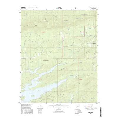
2017 Map of Hamilton
USGS Topo · Published 2017About this map
Lake Ouachita dominates the southern landscape of this 2017 survey, where its complex shoreline meets the high ridges of the Ouachita National Forest. The map details a transition from the water's edge to the prominent heights of Blue Ouachita Mtn and the Ouachita Pinnacle, illustrating the dramatic topographic relief of the region. Local transit and recreation are defined by the Ouachita National Recreation Trail and a network of Forest Service roads such as National Guard Rd and Crystal Mine Rd.
Find a feature on this map
96 named features on this map. Tap any name to fly to it.
Don’t see what you’re looking for? This feature index may not catch every label — zoom into the map to look around manually.
Map Details
Editions of this 2017 Hamilton Map
This is the sole edition of this map. No revisions or reprints were ever made.
Other maps of this area

1890 · Hot Springs
USGS Topo · 1:125,000

1894 · Hot Springs
USGS Topo · 1:125,000

1955 · Little Rock
USGS Topo · 1:250,000

1956 · Little Rock
USGS Topo · 1:250,000

1960 · Little Rock
USGS Topo · 1:250,000

1962 · Crystal Springs
USGS Topo · 1:24,000

1962 · Avant
USGS Topo · 1:24,000

1964 · Little Rock
USGS Topo · 1:250,000
1966 · Hot Springs North
USGS Topo · 1:24,000
1966 · Mountain Pine
USGS Topo · 1:24,000