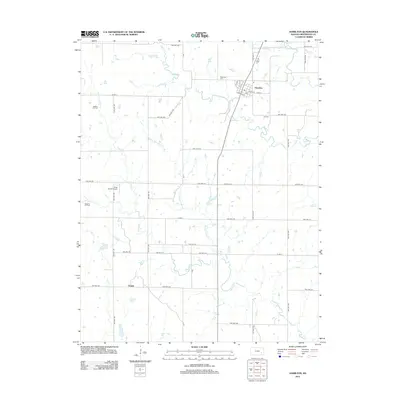
2012 Map of Hamilton
USGS Topo · Published 2012About this map
Hamilton serves as the central hub of this Greenwood County landscape, where the local grid meets a network of township roads. The community is anchored by its Po and is surrounded by a rural terrain defined by the winding paths of Slate Cr and Homer Cr. The map highlights the local significance of the energy and aviation sectors, noting the Gaffney Oil Field to the northwest and the Wiggins Oil Field further south, alongside the King Ranch Airport. For those researching local families, Township Cem and Ott Cem are clearly marked. The boundaries of Chelsea Township encompass a mosaic of sections, revealing a systematic 19th-century land division that persists into the 21st century. Smaller waterways like Orion Cr and Willow Cr drain the eastern reaches, where cattle ranching and oil production have long defined the local economy.
Find a feature on this map
46 named features on this map. Tap any name to fly to it.
Don’t see what you’re looking for? This feature index may not catch every label — zoom into the map to look around manually.
Map Details
Editions of this 2012 Hamilton Map
This is the sole edition of this map. No revisions or reprints were ever made.
Other maps of this area

1885 · Eureka
USGS Topo · 1:125,000

1888 · Emporia
USGS Topo · 1:125,000

1888 · Eureka
USGS Topo · 1:125,000

1894 · Emporia
USGS Topo · 1:125,000

1894 · Eureka
USGS Topo · 1:125,000

1955 · Wichita
USGS Topo · 1:250,000

1955 · Hutchinson
USGS Topo · 1:250,000

1958 · Wichita
USGS Topo · 1:250,000

1959 · Hutchinson
USGS Topo · 1:250,000

1967 · Madison SW
USGS Topo · 1:24,000