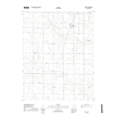
2018 Map of Hamilton
USGS Topo · Published 2018About this map
The town of Hamilton serves as the central hub of this Greenwood County landscape, where the prairie is defined by the winding paths of Slate Creek and Homer Creek. This 2018 survey documents a region rooted in agricultural tradition and local genealogy, evidenced by the preservation of sites like Township Cem, Ott Cem, and Homer Creek Cem. The drainage patterns of Willow Creek and its tributaries carve the undulating terrain of Chelsea Township, revealing a rural infrastructure of section-line roads such as Co Rd 4 and Twp Rd 291. While the settlement of Utopia marks the southern portion of the quadrangle, the presence of the King Ranch Airport suggests the continued importance of regional transport and large-scale ranching operations in this part of Kansas.
Find a feature on this map
59 named features on this map. Tap any name to fly to it.
Don’t see what you’re looking for? This feature index may not catch every label — zoom into the map to look around manually.
Map Details
Editions of this 2018 Hamilton Map
This is the sole edition of this map. No revisions or reprints were ever made.
Other maps of this area

1885 · Eureka
USGS Topo · 1:125,000

1888 · Emporia
USGS Topo · 1:125,000

1888 · Eureka
USGS Topo · 1:125,000

1894 · Emporia
USGS Topo · 1:125,000

1894 · Eureka
USGS Topo · 1:125,000

1955 · Wichita
USGS Topo · 1:250,000

1955 · Hutchinson
USGS Topo · 1:250,000

1958 · Wichita
USGS Topo · 1:250,000

1959 · Hutchinson
USGS Topo · 1:250,000

1967 · Madison SW
USGS Topo · 1:24,000