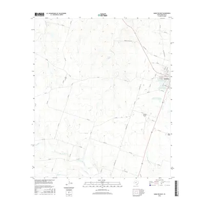
2016 Map of Hamilton West
USGS Topo · Published 2016About this map
Hamilton serves as the primary hub of this Central Texas landscape, situated at the eastern edge of a terrain defined by complex water systems and agricultural infrastructure. To the west, the winding paths of Cowhouse Cr and its tributaries, including the Spring Br Hiller Slough and Gholson Cr, drain the cattle country of Hamilton County. The map details a sophisticated water management network featuring the Soil Conservation Service Site 2 Reservoir and others that dot the drainage basins of Bear Cr and S Mesquite Cr.
Find a feature on this map
63 named features on this map. Tap any name to fly to it.
Don’t see what you’re looking for? This feature index may not catch every label — zoom into the map to look around manually.
Map Details
Editions of this 2016 Hamilton West Map
This is the sole edition of this map. No revisions or reprints were ever made.
Other maps of this area

1888 · Hamilton
USGS Topo · 1:125,000

1894 · Hamilton
USGS Topo · 1:125,000

1954 · Brownwood
USGS Topo · 1:250,000

1956 · Gustine
USGS Topo · 1:62,500

1956 · Gentrys Mill
USGS Topo · 1:24,000

1956 · Pottsville
USGS Topo · 1:62,500
1956 · Ohio
USGS Topo · 1:24,000

1956 · Hico
USGS Topo · 1:62,500

1956 · Hamilton
USGS Topo · 1:62,500

1956 · Hamilton West
USGS Topo · 1:24,000