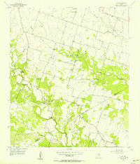
1956 Map of Ohio
USGS Topo · Published 1957About this map
Ohio sits at the heart of this mid-century rural landscape, a settlement defined by its water crossings and small-scale community landmarks. The winding paths of Cowhouse Creek and Mustang Creek dictate the layout of the local transport network, evidenced by specialized transit points such as Parsley Ford Crossing, Ballard Crossing, and Slab Crossing. A sense of local transition is visible through the infrastructure, notably the Old Railroad Grade and several institutions marked as out of use, including St Pauls Sch (Abnd) and Liberty Sch (Abnd). Religious life remains central to the map's geography at Live Oak Ch and St Pauls Ch. Scattered Caliche Pits suggest the area's geological utility, while the boundary between Hamilton and Coryell counties bisects the southern reaches of the quadrangle.
Find a feature on this map
21 named features on this map. Tap any name to fly to it.
Don’t see what you’re looking for? This feature index may not catch every label — zoom into the map to look around manually.
Map Details
Editions of this 1956 Ohio Map
2 editions found
Other maps of this area

1887 · Lampasas
USGS Topo · 1:125,000

1888 · Hamilton
USGS Topo · 1:125,000

1888 · Meridian
USGS Topo · 1:125,000

1894 · Hamilton
USGS Topo · 1:125,000

1894 · Meridian
USGS Topo · 1:125,000

1894 · Lampasas
USGS Topo · 1:125,000

1894 · Gatesville
USGS Topo · 1:125,000

1947 · Purmela
USGS Topo · 1:62,500

1947 · Purmela
USGS Topo · 1:24,000

1954 · Brownwood
USGS Topo · 1:250,000