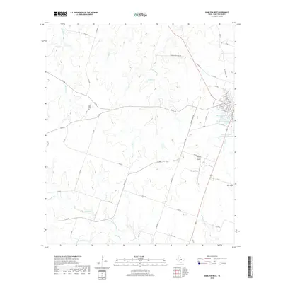
2019 Map of Hamilton West
USGS Topo · Published 2019About this map
Hamilton serves as the focal point for this Central Texas landscape, where the western edges of the city meet the rural ranchlands of Hamilton County. The terrain is defined by a dense network of tributaries including Bear Cr, Logan Br, and Little Cowhouse Cr that cut through the undulating landscape toward the southeast. Cultural markers like the Center Valley Cem and Blue Ridge provide important reference points for genealogists and local historians tracing family roots in this area west of the county seat.
Find a feature on this map
64 named features on this map. Tap any name to fly to it.
Don’t see what you’re looking for? This feature index may not catch every label — zoom into the map to look around manually.
Map Details
Editions of this 2019 Hamilton West Map
This is the sole edition of this map. No revisions or reprints were ever made.
Other maps of this area

1888 · Hamilton
USGS Topo · 1:125,000

1894 · Hamilton
USGS Topo · 1:125,000

1954 · Brownwood
USGS Topo · 1:250,000

1956 · Gustine
USGS Topo · 1:62,500

1956 · Gentrys Mill
USGS Topo · 1:24,000

1956 · Pottsville
USGS Topo · 1:62,500
1956 · Ohio
USGS Topo · 1:24,000

1956 · Hico
USGS Topo · 1:62,500

1956 · Hamilton
USGS Topo · 1:62,500

1956 · Hamilton West
USGS Topo · 1:24,000