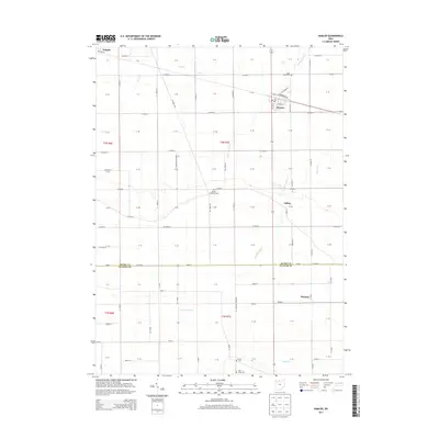
2013 Map of Hamler
USGS Topo · Published 2013About this map
Hamler serves as the primary hub of activity in this 2013 survey, positioned at the intersection of local roads and the village rail line. The landscape is defined by the rigid geometry of Northwest Ohio's agricultural grid, where townships are neatly partitioned by a network of thoroughfares like Co Road F and Co Road 10. This map captures a rural environment where small communities like Gallup and Prentiss anchor the surrounding farmland. Numerous watercourses, including S Turkeyfoot Cr, Brush Cr, and Beaver Cr, provide a natural contrast to the surveyed section lines. Genealogists will find significant value in the documentation of local burial sites, such as Saint Pauls Cem, Marion Township Cem, and Center Cem, which mark the historical footprint of the families who settled this part of Henry and Putnam Counties.
Find a feature on this map
100 named features on this map. Tap any name to fly to it.
Don’t see what you’re looking for? This feature index may not catch every label — zoom into the map to look around manually.
Map Details
Editions of this 2013 Hamler Map
This is the sole edition of this map. No revisions or reprints were ever made.
Other maps of this area

1908 · Ottawa
USGS Topo · 1:62,500

1908 · Napoleon
USGS Topo · 1:62,500

1909 · Mc Clure
USGS Topo · 1:62,500

1953 · Fort Wayne
USGS Topo · 1:250,000

1956 · Fort Wayne
USGS Topo · 1:250,000

1956 · Toledo
USGS Topo · 1:250,000

1959 · Florida
USGS Topo · 1:24,000

1960 · Deshler
USGS Topo · 1:24,000

1960 · Ottawa
USGS Topo · 1:24,000
1960 · New Bavaria
USGS Topo · 1:24,000