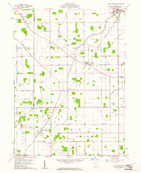
1960 Map of New Bavaria
USGS Topo · Published 1961About this map
New Bavaria serves as the central hub of this agricultural landscape in Henry County, where the grid of rural roads is defined by local surnames such as Steinmaier Road, Schatz Road, and Hoffman Road. The importance of community faith and education in this period is evidenced by the density of institutions like St Stephens Ch and its associated St Stephens Cem, alongside Emanuels Ch and the Sacred Heart Sch. These landmarks anchored the lives of families farming the flatlands between the drainage systems of Lost Creek and North Creek.
Find a feature on this map
36 named features on this map. Tap any name to fly to it.
Don’t see what you’re looking for? This feature index may not catch every label — zoom into the map to look around manually.
Map Details
Editions of this 1960 New Bavaria Map
3 editions found
Other maps of this area

1907 · Defiance
USGS Topo · 1:62,500

1908 · Ottawa
USGS Topo · 1:62,500

1908 · Napoleon
USGS Topo · 1:62,500

1909 · Defiance
USGS Topo · 1:62,500

1909 · Continental
USGS Topo · 1:62,500

1953 · Fort Wayne
USGS Topo · 1:250,000

1956 · Fort Wayne
USGS Topo · 1:250,000

1959 · Defiance East
USGS Topo · 1:24,000

1959 · Florida
USGS Topo · 1:24,000

1960 · Ottawa
USGS Topo · 1:24,000