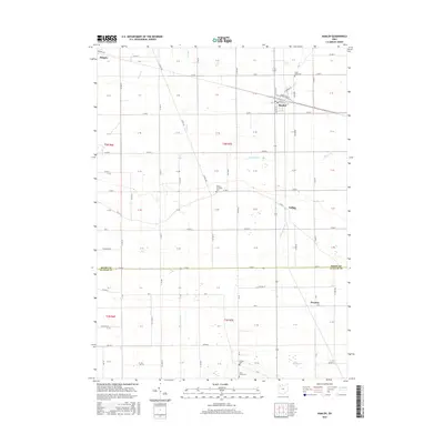
2016 Map of Hamler
USGS Topo · Published 2016About this map
Hamler serves as a central hub in this agricultural landscape near the Henry and Putnam County line. The town's grid, including N Marion St and Edgerton St, is situated at a key rail junction, reflecting the region's historic reliance on transportation for moving crops. The surrounding countryside is defined by a dense network of county roads and drainage ways like S Turkeyfoot Cr and West Cr, which are essential to the productivity of these former swamplands.
Find a feature on this map
103 named features on this map. Tap any name to fly to it.
Don’t see what you’re looking for? This feature index may not catch every label — zoom into the map to look around manually.
Map Details
Editions of this 2016 Hamler Map
This is the sole edition of this map. No revisions or reprints were ever made.
Other maps of this area

1908 · Ottawa
USGS Topo · 1:62,500

1908 · Napoleon
USGS Topo · 1:62,500

1909 · Mc Clure
USGS Topo · 1:62,500

1953 · Fort Wayne
USGS Topo · 1:250,000

1956 · Fort Wayne
USGS Topo · 1:250,000

1956 · Toledo
USGS Topo · 1:250,000

1959 · Florida
USGS Topo · 1:24,000

1960 · Deshler
USGS Topo · 1:24,000

1960 · Ottawa
USGS Topo · 1:24,000
1960 · New Bavaria
USGS Topo · 1:24,000