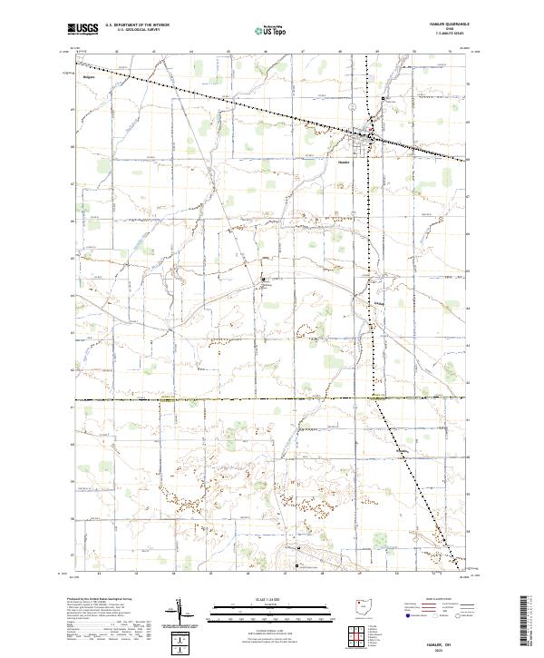
2023 Map of Hamler
USGS Topo · Published 2023About this map
The agrarian landscape of Henry and Putnam counties is defined by a complex network of man-made and natural drainage, necessary for the fertile but low-lying plains of Northwest Ohio. Hamler serves as the primary hub, where N Marion St and Belton St intersect near the village center. The surrounding rural sections are dotted with significant sites for local history and genealogy, including Saint Pauls Cem to the north and Marion Township Cem located centrally. The map reveals the intricate engineering of the land through features like Gustwiller Ditch and Mess Ditch, which work alongside natural waterways like South Turkeyfoot Creek and Beaver Creek to manage the region's water. Smaller crossroads settlements such as Gallup and Prentiss anchor the southern reaches of the township, while the edge of Holgate appears in the northwest corner, illustrating the persistent settlement patterns of this farming heartland.
Find a feature on this map
67 named features on this map. Tap any name to fly to it.
Don’t see what you’re looking for? This feature index may not catch every label — zoom into the map to look around manually.
Map Details
Editions of this 2023 Hamler Map
This is the sole edition of this map. No revisions or reprints were ever made.
Other maps of this area

1908 · Ottawa
USGS Topo · 1:62,500

1908 · Napoleon
USGS Topo · 1:62,500

1909 · Mc Clure
USGS Topo · 1:62,500

1953 · Fort Wayne
USGS Topo · 1:250,000

1956 · Fort Wayne
USGS Topo · 1:250,000

1956 · Toledo
USGS Topo · 1:250,000

1959 · Florida
USGS Topo · 1:24,000

1960 · Deshler
USGS Topo · 1:24,000

1960 · Ottawa
USGS Topo · 1:24,000
1960 · New Bavaria
USGS Topo · 1:24,000