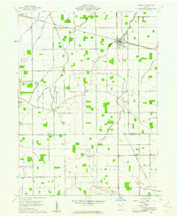
1960 Map of Hamler
USGS Topo · Published 1961About this map
The village of Hamler stands at the critical intersection of two major rail lines, the Baltimore and Ohio and the Detroit Toledo and Ironton, anchoring this 1960s agricultural landscape on the border of Henry and Putnam Counties. The map reveals a highly engineered drainage system essential for Northwest Ohio farming, characterized by numerous man-made channels like Gustwiller Ditch and Mess Ditch that feed into natural waterways such as Turkeyfoot Creek.
Find a feature on this map
29 named features on this map. Tap any name to fly to it.
Don’t see what you’re looking for? This feature index may not catch every label — zoom into the map to look around manually.
Map Details
Editions of this 1960 Hamler Map
2 editions found
Other maps of this area

1908 · Ottawa
USGS Topo · 1:62,500

1908 · Napoleon
USGS Topo · 1:62,500

1909 · Mc Clure
USGS Topo · 1:62,500

1953 · Fort Wayne
USGS Topo · 1:250,000

1956 · Fort Wayne
USGS Topo · 1:250,000

1956 · Toledo
USGS Topo · 1:250,000

1959 · Florida
USGS Topo · 1:24,000

1960 · Deshler
USGS Topo · 1:24,000

1960 · Ottawa
USGS Topo · 1:24,000
1960 · New Bavaria
USGS Topo · 1:24,000