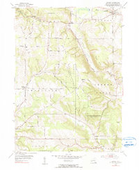
1954 Map of Hamlet
USGS Topo · Published 1990About this map
Charlotte Center and Sinclairville anchor this mid-century portrait of Chautauqua County, where the landscape transitions from the small farming hubs of Griswold and Thornton to the protected woodlands of the State Reforestation Area Chautauqua No 7. The terrain is defined by a series of prominent rises including Dibble Hill, Luce Hill, and Boutwell Hill, separated by a network of waterways like Mill Creek and Clear Creek. The map documents the enduring rural infrastructure of the era, recording local landmarks such as Sch No 2 and Burnham Hollow Cem. A complex web of dirt and secondary roads, including Farrington Hollow Road and Tackley Road, connects the townships of Arkwright, Villenova, and Charlotte, reflecting the agricultural and conservation patterns that shaped this section of the Allegheny Plateau during the 1950s.
Find a feature on this map
58 named features on this map. Tap any name to fly to it.
Don’t see what you’re looking for? This feature index may not catch every label — zoom into the map to look around manually.
Map Details
Editions of this 1954 Hamlet Map
2 editions found
Other maps of this area

1900 · Dunkirk
USGS Topo · 1:62,500

1900 · Cherry Creek
USGS Topo · 1:62,500

1904 · Chautaqua
USGS Topo · 1:62,500

1905 · Jamestown
USGS Topo · 1:62,500

1941 · Cherry Creek
USGS Topo · 1:62,500

1941 · Chautauqua
USGS Topo · 1:62,500

1942 · Jamestown
USGS Topo · 1:62,500

1943 · Dunkirk
USGS Topo · 1:62,500
1954 · Kennedy
USGS Topo · 1:24,000

1954 · Ellery Center
USGS Topo · 1:24,000