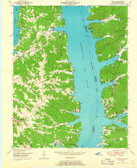
1950 Map of Hamlin
USGS Topo · Published 1966About this map
Fort Heiman and Fort Henry stand as significant historical markers along the banks of the Tennessee River, documenting a strategic landscape within the Kentucky Reservation Boundary. In this 1950 survey, the small settlement of Hamlin and nearby Buchannan are surrounded by numerous family cemeteries such as Blood River Cem and Lassiter Cem, which dot the finger-like ridges overlooking the expanding waters of Kentucky Lake. The topography is defined by deep hollows like Bailey Hollow and rugged terrain such as the Coaling Land, reflecting a rural economy tied to both the river and the inland woods. Local religious life is anchored by New Mt Carmel Church and Azotus Ch, while the presence of Minnow rearing pools and Camp Tischel suggests the area's mid-century transition toward recreation and conservation under the Tennessee Valley Authority.
Find a feature on this map
54 named features on this map. Tap any name to fly to it.
Don’t see what you’re looking for? This feature index may not catch every label — zoom into the map to look around manually.
Map Details
Editions of this 1950 Hamlin Map
3 editions found
Other maps of this area

1936 · Buchanan
USGS Topo · 1:24,000

1936 · Tharpe
USGS Topo · 1:24,000

1936 · New Concord
USGS Topo · 1:24,000

1936 · Hamlin
USGS Topo · 1:24,000

1936 · Centerville Landing
USGS Topo · 1:24,000

1936 · Rushing
USGS Topo · 1:24,000

1936 · Standing Rock
USGS Topo · 1:24,000

1936 · Hico
USGS Topo · 1:24,000

1942 · New Concord
USGS Topo · 1:24,000

1942 · Hico
USGS Topo · 1:24,000