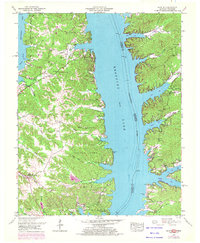
1950 Map of Hamlin
USGS Topo · Published 1972About this map
Fort Heiman and the Fort Henry (Former site) anchor the southern reach of this survey, marking critical Civil War-era positions along the heights and banks of the Tennessee River. Following the creation of Kentucky Lake, the landscape reveals a complex shoreline of deep inlets like Byrd Bay and Panther Bay, where the rising waters reshaped the valleys of the Blood River and its tributaries.
Find a feature on this map
54 named features on this map. Tap any name to fly to it.
Don’t see what you’re looking for? This feature index may not catch every label — zoom into the map to look around manually.
Map Details
Editions of this 1950 Hamlin Map
3 editions found
Other maps of this area

1936 · Buchanan
USGS Topo · 1:24,000

1936 · Tharpe
USGS Topo · 1:24,000

1936 · New Concord
USGS Topo · 1:24,000

1936 · Hamlin
USGS Topo · 1:24,000

1936 · Centerville Landing
USGS Topo · 1:24,000

1936 · Rushing
USGS Topo · 1:24,000

1936 · Standing Rock
USGS Topo · 1:24,000

1936 · Hico
USGS Topo · 1:24,000

1942 · New Concord
USGS Topo · 1:24,000

1942 · Hico
USGS Topo · 1:24,000