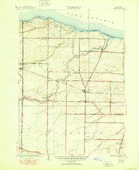
1935 Map of Hamlin
USGS Topo · Published 1950About this map
Lake Ontario defines the northern reaches of this agrarian landscape, where the shoreline is marked by prominent landmarks like Devils Nose and Bluff Beach. In the mid-1930s, the rural character of the region is evident in the dense network of one-room schoolhouses, including School No 12 and School No 8, which served the farming families of Hamlin and Clarkson. The village of Hamlin sits as a central hub, connected to the wider world by the New York Central Railroad passing through Hamlin Station.
Find a feature on this map
73 named features on this map. Tap any name to fly to it.
Don’t see what you’re looking for? This feature index may not catch every label — zoom into the map to look around manually.
Map Details
Editions of this 1935 Hamlin Map
2 editions found
Other maps of this area

1897 · Albion
USGS Topo · 1:62,500

1897 · Oak Orchard
USGS Topo · 1:62,500

1899 · Hamlin
USGS Topo · 1:62,500

1899 · Brockport
USGS Topo · 1:62,500

1932 · Hamlin
USGS Topo · 1:24,000

1932 · Spencerport
USGS Topo · 1:24,000

1934 · Spencerport
USGS Topo · 1:24,000

1934 · Brockport
USGS Topo · 1:24,000
1934 · Hilton
USGS Topo · 1:24,000

1935 · Hamlin
USGS Topo · 1:24,000