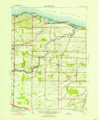
1952 Map of Hamlin
USGS Topo · Published 1953About this map
The shoreline of Lake Ontario defines the northern edge of this 1952 study, where landmarks like Devils Nose and Yanty Marsh sit alongside several public beaches. The landscape reflects a well-established rural school system, with numbered institutions such as School No 12 and School No 4 serving the agricultural community. Settlement centers like Hamlin, Morton, and Kendall Mills are linked by a grid of farm roads and the New York Central Railroad, which cuts across the central part of the quadrangle. Local civic life is anchored by sites like St Johns Parish Hall Sch and the Brockport Waterworks. The map also captures several family-oriented landmarks, including Lakeside Cem and Blossom Cem, providing valuable geographic context for genealogists studying Monroe and Orleans counties during the early post-war era.
Find a feature on this map
45 named features on this map. Tap any name to fly to it.
Don’t see what you’re looking for? This feature index may not catch every label — zoom into the map to look around manually.
Map Details
Editions of this 1952 Hamlin Map
2 editions found
Other maps of this area

1897 · Albion
USGS Topo · 1:62,500

1897 · Oak Orchard
USGS Topo · 1:62,500

1899 · Hamlin
USGS Topo · 1:62,500

1899 · Brockport
USGS Topo · 1:62,500

1932 · Hamlin
USGS Topo · 1:24,000

1932 · Spencerport
USGS Topo · 1:24,000

1934 · Spencerport
USGS Topo · 1:24,000

1934 · Brockport
USGS Topo · 1:24,000
1934 · Hilton
USGS Topo · 1:24,000

1935 · Hamlin
USGS Topo · 1:24,000