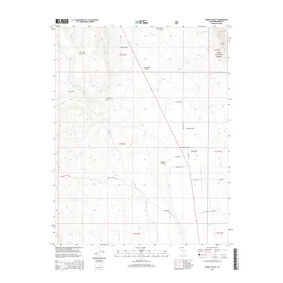
2015 Map of Hammil Valley
USGS Topo · Published 2015About this map
Hammil Valley serves as a prominent geographic basin within the high desert landscape of Mono County, centered on the small settlement of Hammil. The terrain is defined by dramatic canyon systems and springs that descend from the surrounding peaks, including Queen Dicks Canyon and Red Rock Canyon. This 2015 survey reveals an agricultural and ranching landscape characterized by namesake roads such as Cinnamon Ranch Rd, Dawson Ranch Rd, and Zack Ranch Rd. To the west, the topography rises toward Blind Spring Hill, while the eastern portion of the map extends into the Inyo National Forest. Notable water sources such as Yellowjacket Spring and numerous seasonal creeks like Pellisier Cr highlight the critical role of water management in this arid environment, interconnected by historic routes like Slim Princess Way.
Find a feature on this map
33 named features on this map. Tap any name to fly to it.
Don’t see what you’re looking for? This feature index may not catch every label — zoom into the map to look around manually.
Map Details
Editions of this 2015 Hammil Valley Map
This is the sole edition of this map. No revisions or reprints were ever made.
Other maps of this area

1914 · Mt. Morrison
USGS Topo · 1:125,000

1917 · White Mountain
USGS Topo · 1:125,000

1947 · Mariposa
USGS Topo · 1:250,000

1948 · Mariposa
USGS Topo · 1:250,000

1953 · Casa Diablo Mtn
USGS Topo · 1:62,500

1957 · Mariposa
USGS Topo · 1:250,000

1962 · Benton
USGS Topo · 1:62,500

1962 · Glass Mountain
USGS Topo · 1:62,500

1962 · White Mtn. Peak
USGS Topo · 1:62,500

1963 · Mariposa
USGS Topo · 1:250,000