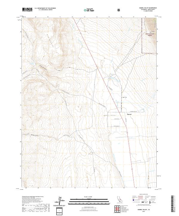
2021 Map of Hammil Valley
USGS Topo · Published 2021About this map
Hammil Valley serves as a stark high-desert corridor between the Blind Spring Hill to the west and the soaring White Mountains to the east. At the center of this agricultural and ranching landscape sits the settlement of Hammil, where local access is defined by family-named routes such as Dawson Ranch Rd and Cinnamon Ranch Rd. The northeastern portion of the quadrangle reaches into the protected lands of the Inyo National Forest, encompassing the steep descent of Falls Canyon.
Find a feature on this map
35 named features on this map. Tap any name to fly to it.
Don’t see what you’re looking for? This feature index may not catch every label — zoom into the map to look around manually.
Map Details
Editions of this 2021 Hammil Valley Map
This is the sole edition of this map. No revisions or reprints were ever made.
Other maps of this area

1914 · Mt. Morrison
USGS Topo · 1:125,000

1917 · White Mountain
USGS Topo · 1:125,000

1947 · Mariposa
USGS Topo · 1:250,000

1948 · Mariposa
USGS Topo · 1:250,000

1953 · Casa Diablo Mtn
USGS Topo · 1:62,500

1957 · Mariposa
USGS Topo · 1:250,000

1962 · Benton
USGS Topo · 1:62,500

1962 · Glass Mountain
USGS Topo · 1:62,500

1962 · White Mtn. Peak
USGS Topo · 1:62,500

1963 · Mariposa
USGS Topo · 1:250,000