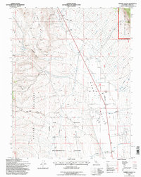
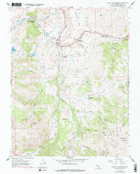
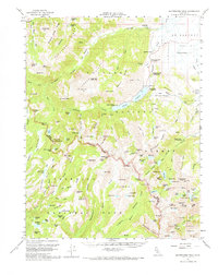
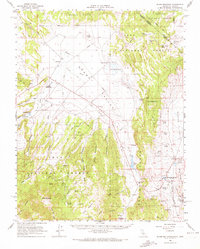
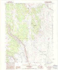
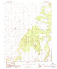
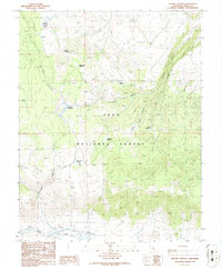
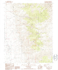
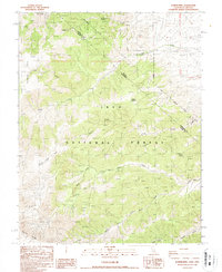
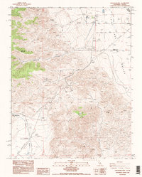
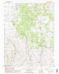
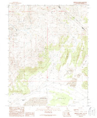
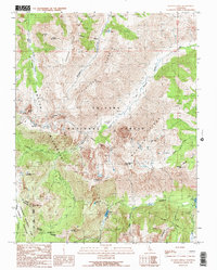
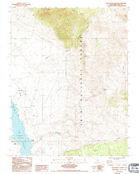
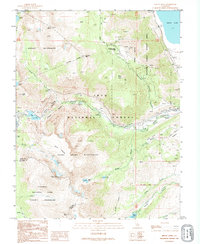
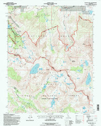
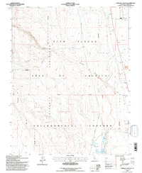
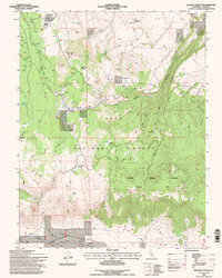
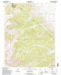
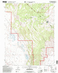
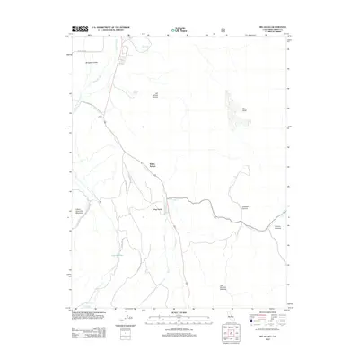
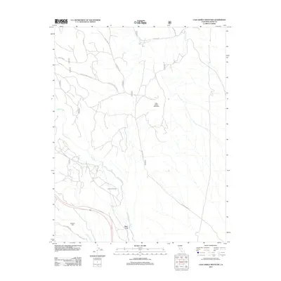
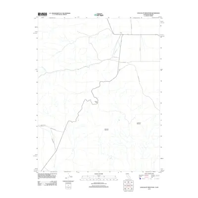
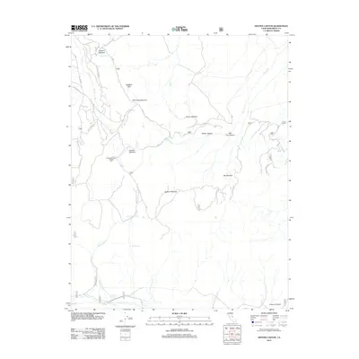
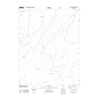
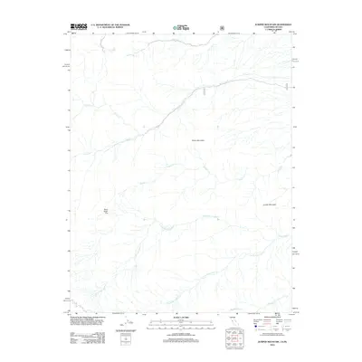
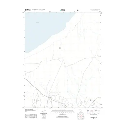
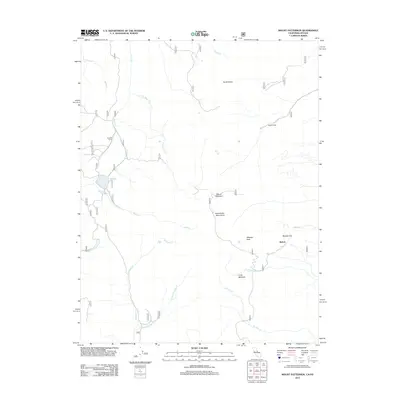
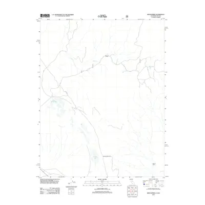
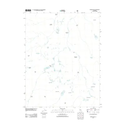
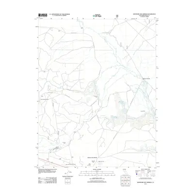
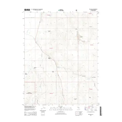
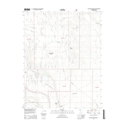
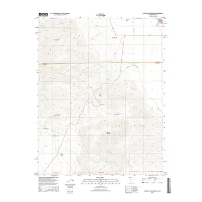
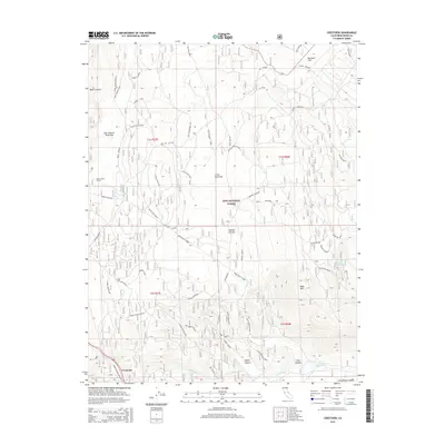
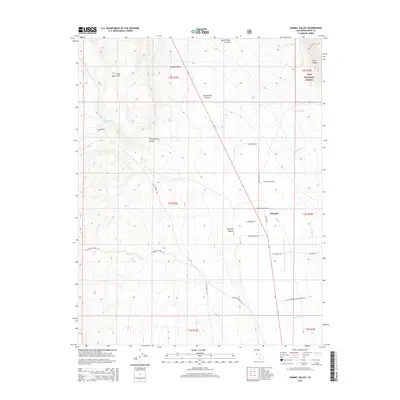
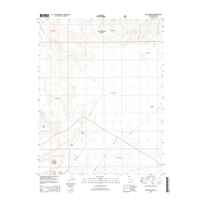
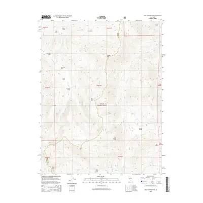
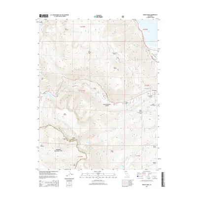
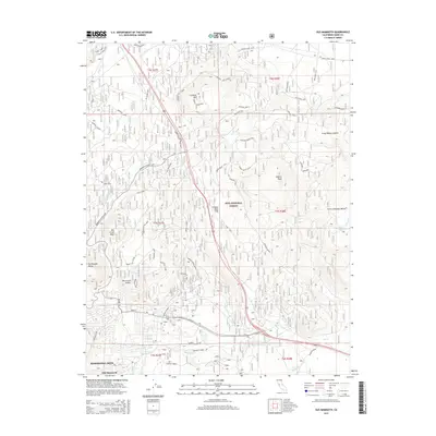
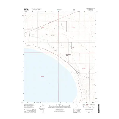
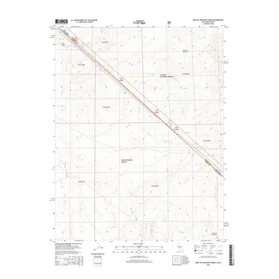
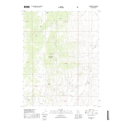
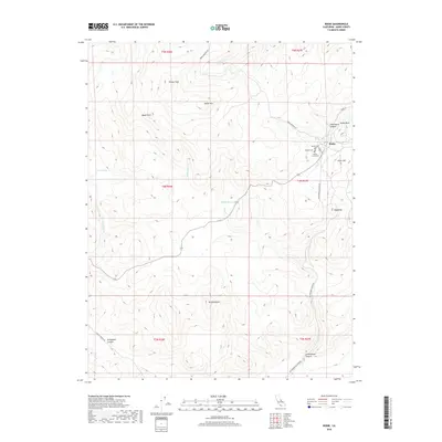
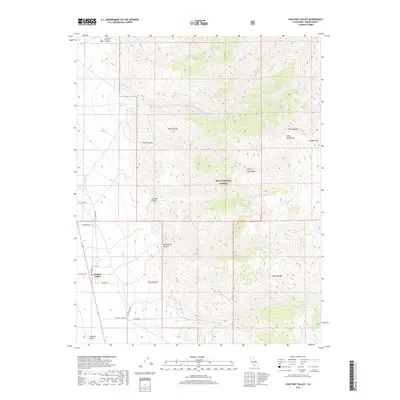
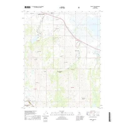
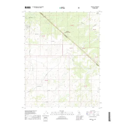
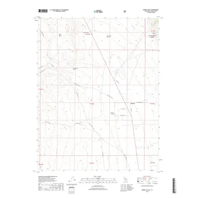
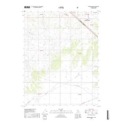
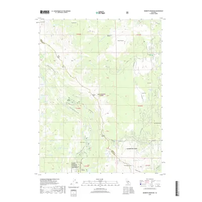
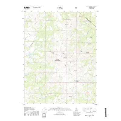
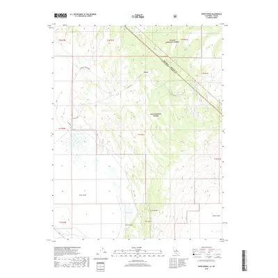
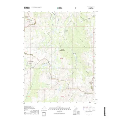
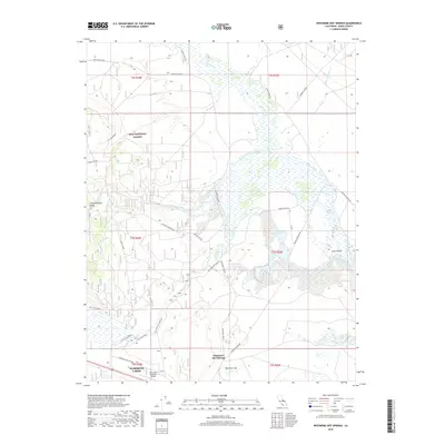
1994 Map of Hammil Valley
USGS Topo · Published 1997About this map
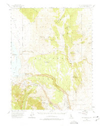
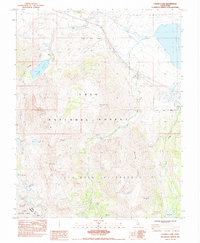
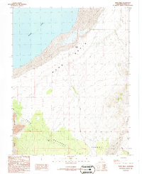
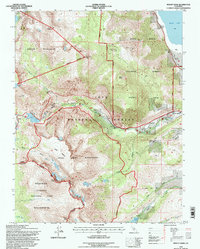
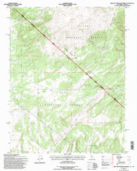
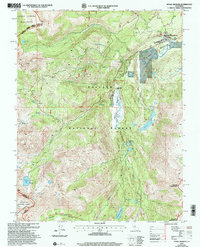
Blind Spring Hill and the Volcanic Tableland dominate this high-desert landscape in Mono County, where the desert floor meets the rising slopes of the Inyo National Forest. This 1994 revision, based on imagery dating back to 1954, documents a region defined by extraction and resource management. Numerous Open Pit Mines and scattered prospects are mapped across the western ridges, including the Silver Reef Mine near Yellowjacket Canyon. The settlement of Hammil (Site) is recorded as a former location on the valley floor, adjacent to a utility corridor and a local Landing Strip. Water resources are central to the map's details, showing a network of aqueducts and wells supporting agricultural activity like feedlots and the ecologically sensitive Fish Slough, which is designated here as part of an Environmental Area of Critical Concern.
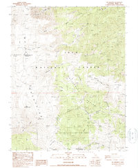
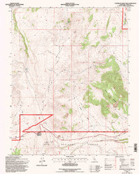
Find a feature on this map
43 named features on this map. Tap any name to fly to it.
Don’t see what you’re looking for? This feature index may not catch every label — zoom into the map to look around manually.
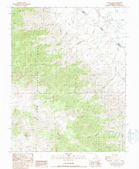
Map Details
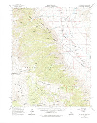
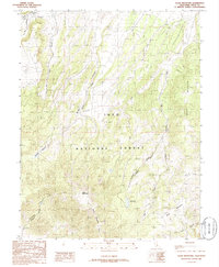
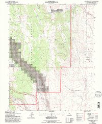
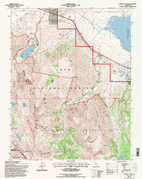
Editions of this 1994 Hammil Valley Map
This is the sole edition of this map. No revisions or reprints were ever made.
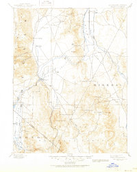
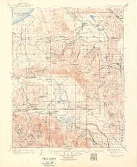
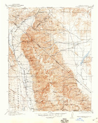
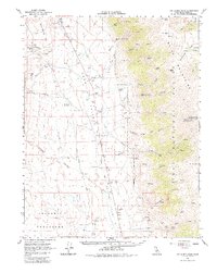
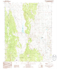
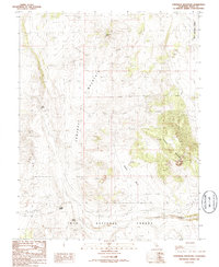
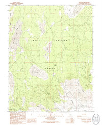
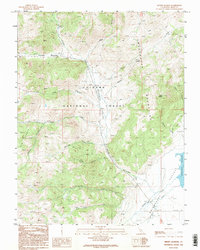
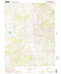
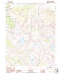
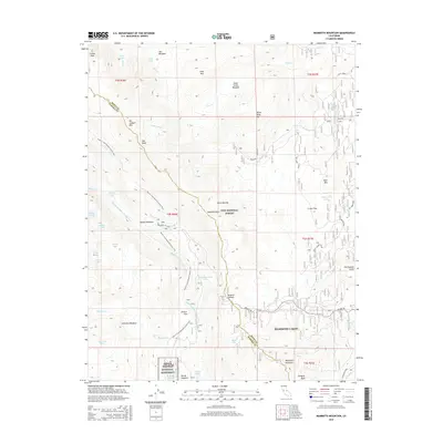
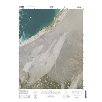
Historical Maps of Hammil Through Time
295 maps found

1891 Wellington
Mono County, CA
1893 Wellington
Mono County, CA
1914 Mt. Morrison
Mono County, CA
1917 White Mountain
Mono County, CA
1953 Casa Diablo Mtn
Mono County, CA
1953 Mono Craters
Mono County, CA
1953 Mt. Morrison
Mono County, CA
1954 Chris Flat
Mono County, CA
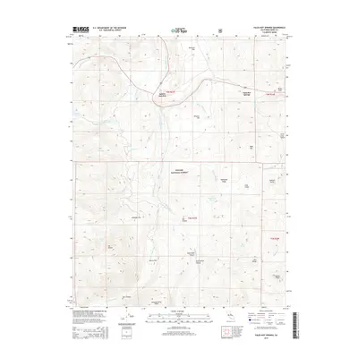
1954 Fales Hot Springs
Mono County, CA
1954 Lost Cannon Peak
Mono County, CA
1954 Pickel Meadow
Mono County, CA
1956 Fales Hot Springs
Mono County, CA
1956 Matterhorn Peak
Mono County, CA
1956 Sonora Pass
Mono County, CA

1958 Bodie
Mono County, CA
1958 Trench Canyon
Mono County, CA
1962 Cowtrack Mtn
Mono County, CA
1962 Glass Mountain
Mono County, CA
1962 Mt. Barcroft
Mono County, CA
1962 White Mtn. Peak
Mono County, CA
1983 Bloody Mountain
Mono County, CA
1983 Convict Lake
Mono County, CA
1983 Old Mammoth
Mono County, CA
1983 Whitmore Hot Sprs
Mono County, CA
1984 Banner Ridge
Mono County, CA
1984 Casa Diablo Mtn
Mono County, CA
1984 Mammoth Mtn.
Mono County, CA
1984 Toms Place
Mono County, CA
1984 Watterson Canyon
Mono County, CA
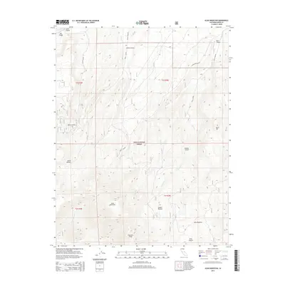
1986 Alameda Well
Mono County, CA
1986 Benton Hot Springs
Mono County, CA
1986 Cowtrack Mountain
Mono County, CA
1986 Crestview
Mono County, CA
1986 Dexter Canyon
Mono County, CA
1986 Glass Mountain
Mono County, CA
1986 Indian Meadows
Mono County, CA
1986 Lundy
Mono County, CA
1986 Mono Mills
Mono County, CA
1986 Negit Island
Mono County, CA
1986 River Spring
Mono County, CA
1986 Sulphur Pond
Mono County, CA
1987 Chalfant Valley
Mono County, CA
1987 Chidago Canyon
Mono County, CA
1987 Hammil Valley
Mono County, CA
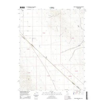
1987 Indian Garden Creek
Mono County, CA
1987 Juniper Mtn
Mono County, CA
1987 Mt. Barcroft
Mono County, CA
1987 Station Peak
Mono County, CA
1987 White Mtn. Peak
Mono County, CA

1988 Benton Range
Mono County, CA
1988 Chocolate Mtn.
Mono County, CA
1988 Koip Peak
Mono County, CA
1988 Mount Dana
Mono County, CA
1988 West of Huntoon Spring
Mono County, CA
1989 Big Alkali
Mono County, CA
1989 Bodie
Mono County, CA
1989 Cedar Hill
Mono County, CA
1989 Dome Hill
Mono County, CA
1989 Kirkwood Spring
Mono County, CA
1989 Mount Jackson
Mono County, CA
1989 Mount Patterson
Mono County, CA
1990 Bloody Mountain
Mono County, CA
1990 Buckeye Ridge
Mono County, CA
1990 Dunderberg Peak
Mono County, CA
1990 Toms Place
Mono County, CA
1990 Tower Peak
Mono County, CA
1990 Watterson Canyon
Mono County, CA
1990 Whitmore Hot Sprs
Mono County, CA
1992 Koip Peak
Mono County, CA
1992 Mammoth Mtn
Mono County, CA
1992 Mount Dana
Mono County, CA
1994 Alameda Well
Mono County, CA
1994 Banner Ridge
Mono County, CA
1994 Benton Hot Springs
Mono County, CA
1994 Bloody Mtn.
Mono County, CA
1994 Casa Diablo Mtn
Mono County, CA
1994 Cedar Hill
Mono County, CA
1994 Chalfant Valley
Mono County, CA
1994 Chidago Canyon
Mono County, CA
1994 Convict Lake
Mono County, CA
1994 Cowtrack Mountain
Mono County, CA
1994 Crestview
Mono County, CA
1994 Dexter Canyon
Mono County, CA
1994 Dunderberg Peak
Mono County, CA
1994 Glass Mountain
Mono County, CA
1994 Hammil Valley
Mono County, CA
1994 Indian Meadows
Mono County, CA
1994 Juniper Mountain
Mono County, CA
1994 Koip Peak
Mono County, CA
1994 Lundy
Mono County, CA
1994 Mammoth Mtn
Mono County, CA

1994 Mono Mills
Mono County, CA
1994 Mount Dana
Mono County, CA
1994 Mt. Barcroft
Mono County, CA
1994 Negit Island
Mono County, CA
1994 Old Mammoth
Mono County, CA
1994 River Spring
Mono County, CA
1994 Station Peak
Mono County, CA

1994 Sulphur Pond
Mono County, CA
1994 Toms Place
Mono County, CA
1994 Watterson Canyon
Mono County, CA
1994 West of Huntoon Spring
Mono County, CA
1994 White Mtn. Peak
Mono County, CA
1994 Whitmore Hot Sprs
Mono County, CA
1998 Bodie
Mono County, CA
2001 Pickel Meadow
Mono County, CA
2001 Tower Peak
Mono County, CA
2012 Alameda Well
Mono County, CA

2012 Banner Ridge
Mono County, CA
2012 Benton Hot Springs
Mono County, CA
2012 Big Alkali
Mono County, CA
2012 Bloody Mountain
Mono County, CA
2012 Bodie
Mono County, CA
2012 Buckeye Ridge
Mono County, CA
2012 Casa Diablo Mountain
Mono County, CA
2012 Cedar Hill
Mono County, CA
2012 Chalfant Valley
Mono County, CA
2012 Chidago Canyon
Mono County, CA
2012 Chocolate Mountain
Mono County, CA
2012 Chris Flat
Mono County, CA

2012 Convict Lake
Mono County, CA
2012 Cowtrack Mountain
Mono County, CA
2012 Crestview
Mono County, CA
2012 Dexter Canyon
Mono County, CA
2012 Dome Hill
Mono County, CA
2012 Dunderberg Peak
Mono County, CA
2012 Fales Hot Springs
Mono County, CA
2012 Glass Mountain
Mono County, CA
2012 Hammil Valley
Mono County, CA
2012 Indian Garden Creek
Mono County, CA
2012 Indian Meadows
Mono County, CA
2012 Juniper Mountain
Mono County, CA

2012 Kirkwood Spring
Mono County, CA
2012 Koip Peak
Mono County, CA

2012 Lost Cannon Peak
Mono County, CA
2012 Lundy
Mono County, CA
2012 Mammoth Mountain
Mono County, CA
2012 Mono Mills
Mono County, CA
2012 Mount Barcroft
Mono County, CA
2012 Mount Dana
Mono County, CA
2012 Mount Jackson
Mono County, CA
2012 Mount Patterson
Mono County, CA
2012 Negit Island
Mono County, CA
2012 Old Mammoth
Mono County, CA
2012 Pickel Meadow
Mono County, CA
2012 River Spring
Mono County, CA
2012 Station Peak
Mono County, CA
2012 Sulphur Pond
Mono County, CA
2012 Toms Place
Mono County, CA
2012 Tower Peak
Mono County, CA
2012 Watterson Canyon
Mono County, CA
2012 West of Huntoon Spring
Mono County, CA
2012 White Mountain Peak
Mono County, CA
2012 Whitmore Hot Springs
Mono County, CA
2015 Alameda Well
Mono County, CA
2015 Banner Ridge
Mono County, CA
2015 Benton Hot Springs
Mono County, CA
2015 Big Alkali
Mono County, CA
2015 Bloody Mountain
Mono County, CA
2015 Bodie
Mono County, CA
2015 Buckeye Ridge
Mono County, CA
2015 Casa Diablo Mountain
Mono County, CA
2015 Cedar Hill
Mono County, CA
2015 Chalfant Valley
Mono County, CA
2015 Chidago Canyon
Mono County, CA
2015 Chocolate Mountain
Mono County, CA
2015 Chris Flat
Mono County, CA
2015 Convict Lake
Mono County, CA
2015 Cowtrack Mountain
Mono County, CA
2015 Crestview
Mono County, CA
2015 Dexter Canyon
Mono County, CA
2015 Dome Hill
Mono County, CA
2015 Dunderberg Peak
Mono County, CA
2015 Fales Hot Springs
Mono County, CA
2015 Glass Mountain
Mono County, CA
2015 Hammil Valley
Mono County, CA
2015 Indian Garden Creek
Mono County, CA
2015 Indian Meadows
Mono County, CA
2015 Juniper Mountain
Mono County, CA
2015 Kirkwood Spring
Mono County, CA
2015 Koip Peak
Mono County, CA
2015 Lost Cannon Peak
Mono County, CA

2015 Lundy
Mono County, CA
2015 Mammoth Mountain
Mono County, CA
2015 Mono Mills
Mono County, CA
2015 Mount Barcroft
Mono County, CA
2015 Mount Dana
Mono County, CA
2015 Mount Jackson
Mono County, CA
2015 Mount Patterson
Mono County, CA
2015 Negit Island
Mono County, CA
2015 Old Mammoth
Mono County, CA
2015 Pickel Meadow
Mono County, CA
2015 River Spring
Mono County, CA
2015 Station Peak
Mono County, CA
2015 Sulphur Pond
Mono County, CA
2015 Toms Place
Mono County, CA
2015 Tower Peak
Mono County, CA
2015 Watterson Canyon
Mono County, CA
2015 West of Huntoon Spring
Mono County, CA
2015 White Mountain Peak
Mono County, CA
2015 Whitmore Hot Springs
Mono County, CA
2018 Alameda Well
Mono County, CA
2018 Banner Ridge
Mono County, CA
2018 Benton Hot Springs
Mono County, CA
2018 Big Alkali
Mono County, CA
2018 Bloody Mountain
Mono County, CA
2018 Bodie
Mono County, CA
2018 Buckeye Ridge
Mono County, CA
2018 Casa Diablo Mountain
Mono County, CA
2018 Cedar Hill
Mono County, CA
2018 Chalfant Valley
Mono County, CA
2018 Chidago Canyon
Mono County, CA
2018 Chocolate Mountain
Mono County, CA
2018 Chris Flat
Mono County, CA
2018 Convict Lake
Mono County, CA
2018 Cowtrack Mountain
Mono County, CA
2018 Crestview
Mono County, CA
2018 Dexter Canyon
Mono County, CA
2018 Dome Hill
Mono County, CA
2018 Dunderberg Peak
Mono County, CA
2018 Fales Hot Springs
Mono County, CA
2018 Glass Mountain
Mono County, CA
2018 Hammil Valley
Mono County, CA
2018 Indian Garden Creek
Mono County, CA
2018 Indian Meadows
Mono County, CA
2018 Juniper Mountain
Mono County, CA
2018 Kirkwood Spring
Mono County, CA
2018 Koip Peak
Mono County, CA
2018 Lost Cannon Peak
Mono County, CA
2018 Lundy
Mono County, CA
2018 Mammoth Mountain
Mono County, CA
2018 Mono Mills
Mono County, CA

2018 Mount Barcroft
Mono County, CA
2018 Mount Dana
Mono County, CA
2018 Mount Jackson
Mono County, CA
2018 Mount Patterson
Mono County, CA
2018 Negit Island
Mono County, CA
2018 Old Mammoth
Mono County, CA
2018 Pickel Meadow
Mono County, CA
2018 River Spring
Mono County, CA
2018 Station Peak
Mono County, CA
2018 Sulphur Pond
Mono County, CA
2018 Toms Place
Mono County, CA
2018 Tower Peak
Mono County, CA
2018 Watterson Canyon
Mono County, CA
2018 West of Huntoon Spring
Mono County, CA
2018 White Mountain Peak
Mono County, CA
2018 Whitmore Hot Springs
Mono County, CA
2021 Alameda Well
Mono County, CA
2021 Banner Ridge
Mono County, CA
2021 Benton Hot Springs
Mono County, CA
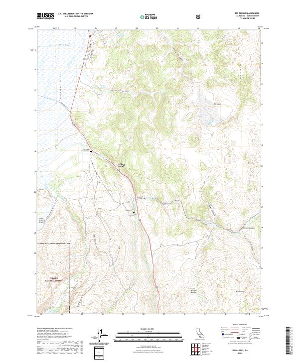
2021 Big Alkali
Mono County, CA
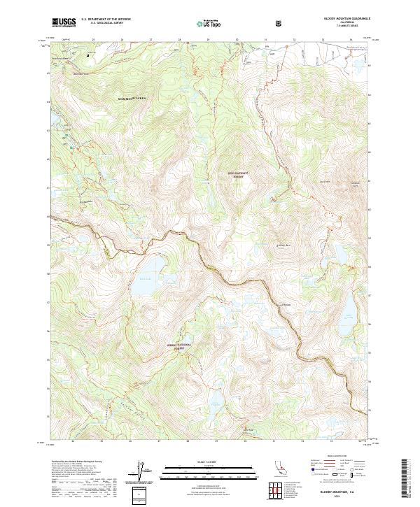
2021 Bloody Mountain
Mono County, CA
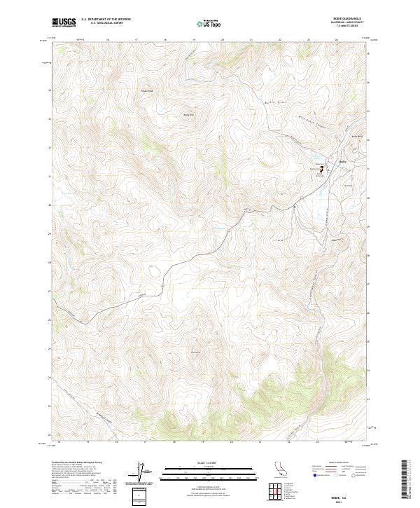
2021 Bodie
Mono County, CA
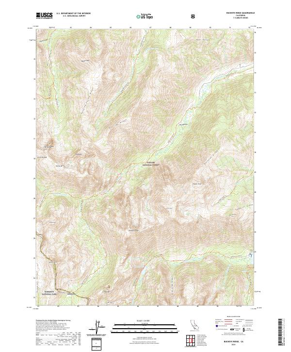
2021 Buckeye Ridge
Mono County, CA
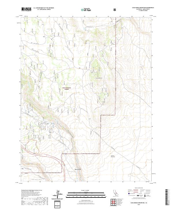
2021 Casa Diablo Mountain
Mono County, CA
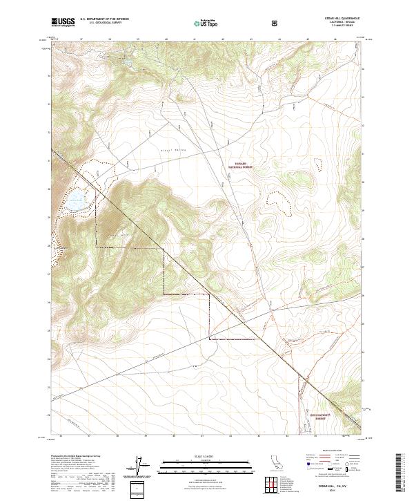
2021 Cedar Hill
Mono County, CA
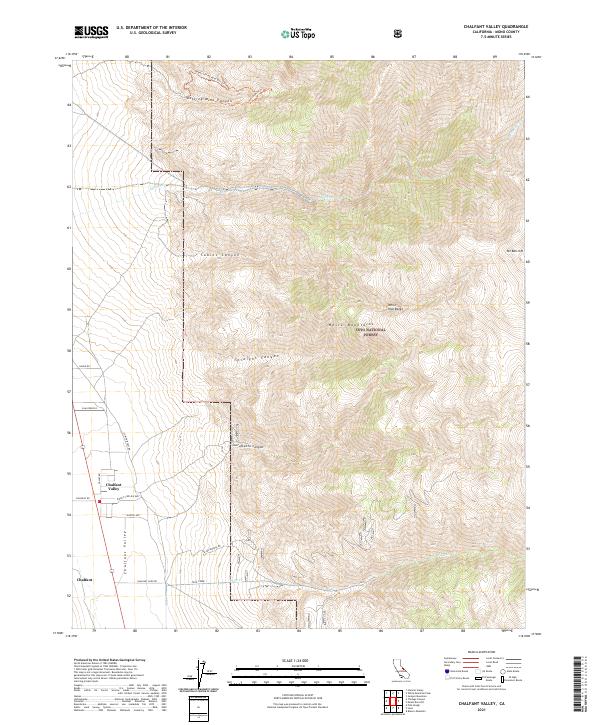
2021 Chalfant Valley
Mono County, CA
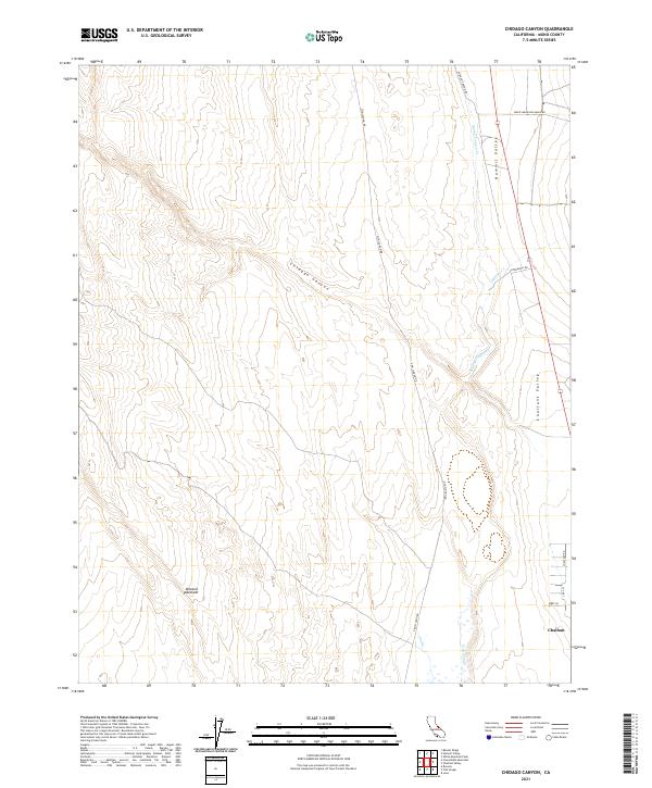
2021 Chidago Canyon
Mono County, CA
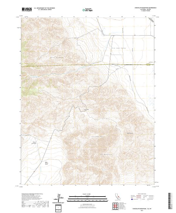
2021 Chocolate Mountain
Mono County, CA
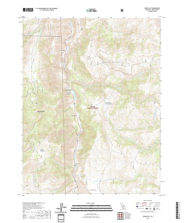
2021 Chris Flat
Mono County, CA
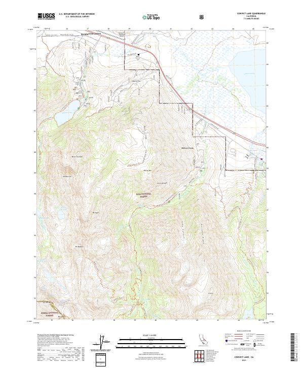
2021 Convict Lake
Mono County, CA
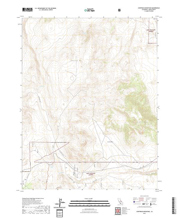
2021 Cowtrack Mountain
Mono County, CA
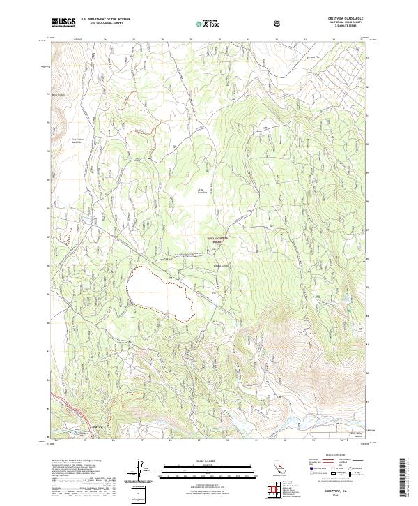
2021 Crestview
Mono County, CA
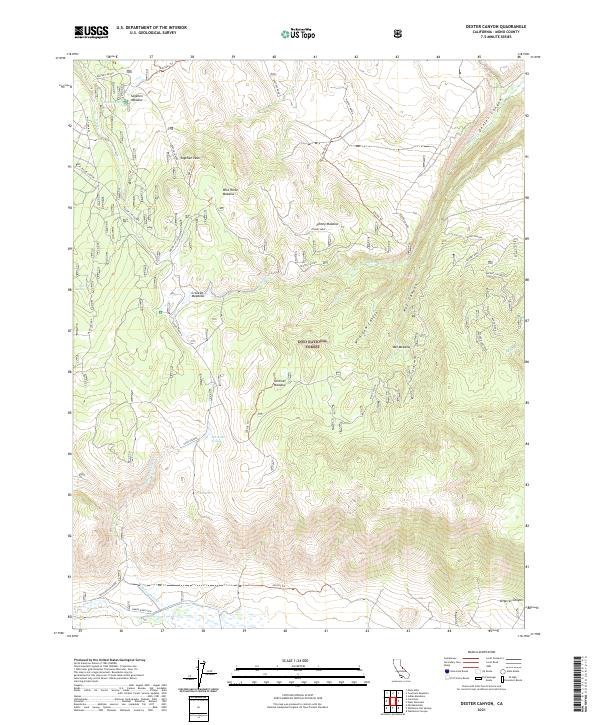
2021 Dexter Canyon
Mono County, CA
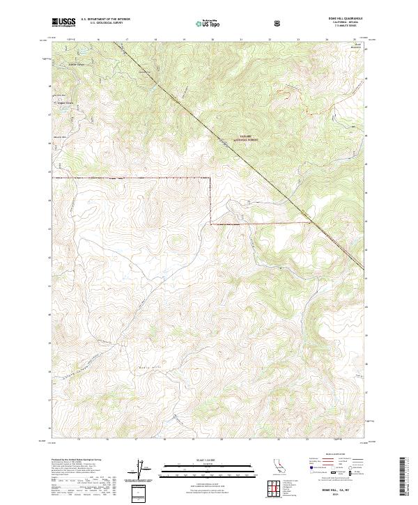
2021 Dome Hill
Mono County, CA
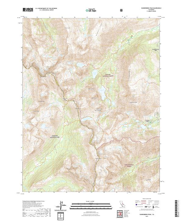
2021 Dunderberg Peak
Mono County, CA
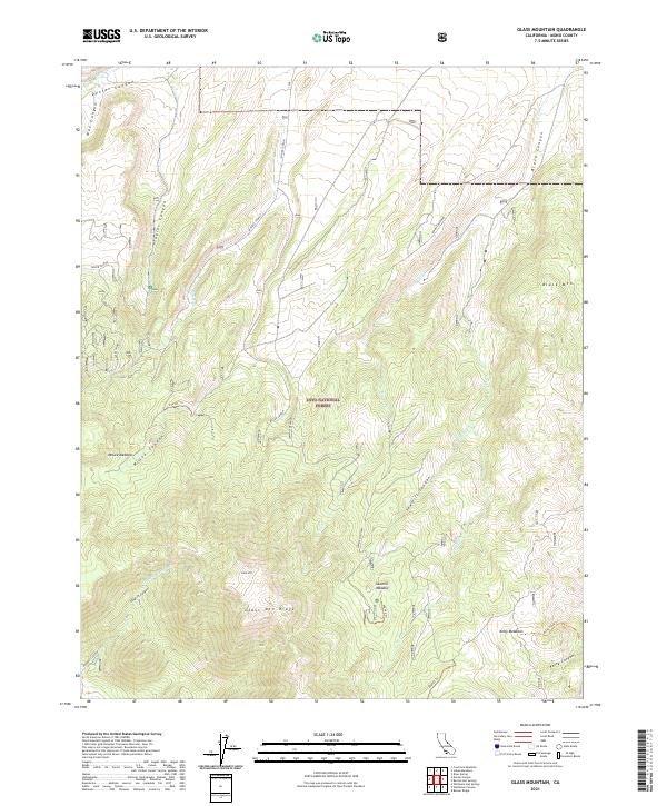
2021 Glass Mountain
Mono County, CA
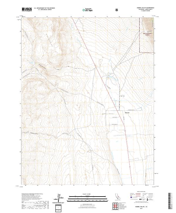
2021 Hammil Valley
Mono County, CA
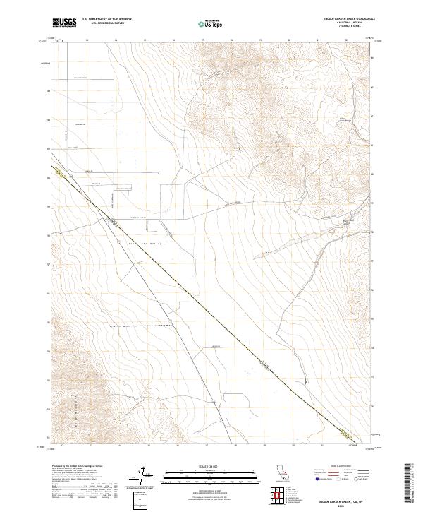
2021 Indian Garden Creek
Mono County, CA
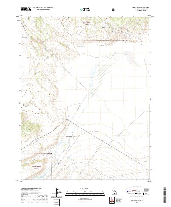
2021 Indian Meadows
Mono County, CA
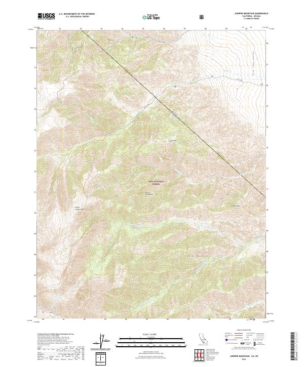
2021 Juniper Mountain
Mono County, CA
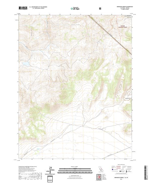
2021 Kirkwood Spring
Mono County, CA
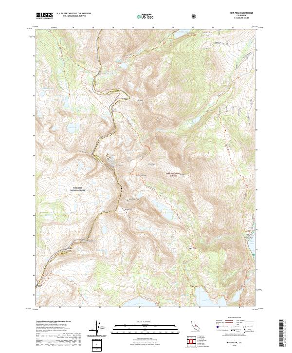
2021 Koip Peak
Mono County, CA

2021 Lost Cannon Peak
Mono County, CA
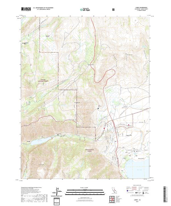
2021 Lundy
Mono County, CA
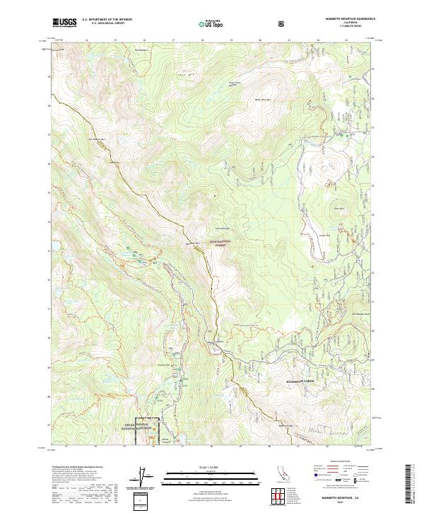
2021 Mammoth Mountain
Mono County, CA
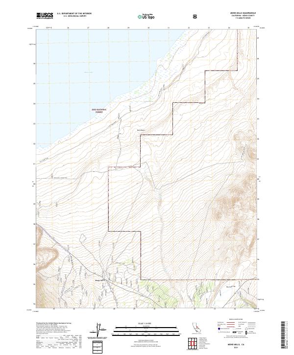
2021 Mono Mills
Mono County, CA
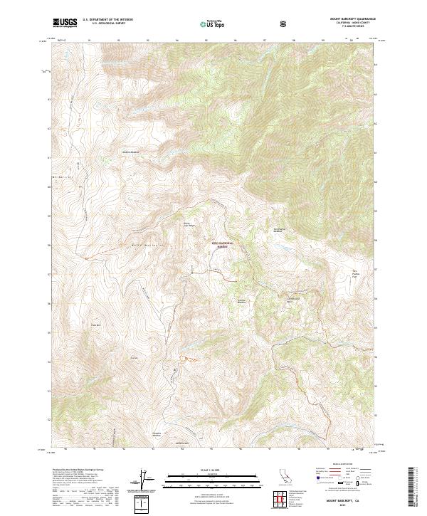
2021 Mount Barcroft
Mono County, CA
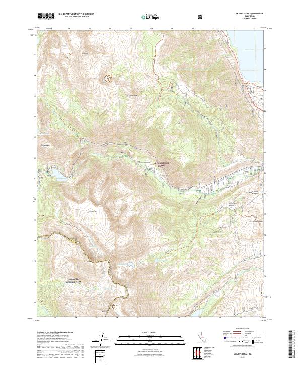
2021 Mount Dana
Mono County, CA
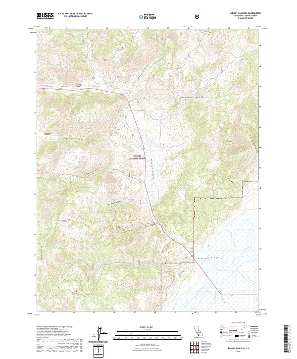
2021 Mount Jackson
Mono County, CA
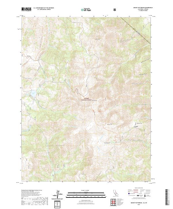
2021 Mount Patterson
Mono County, CA
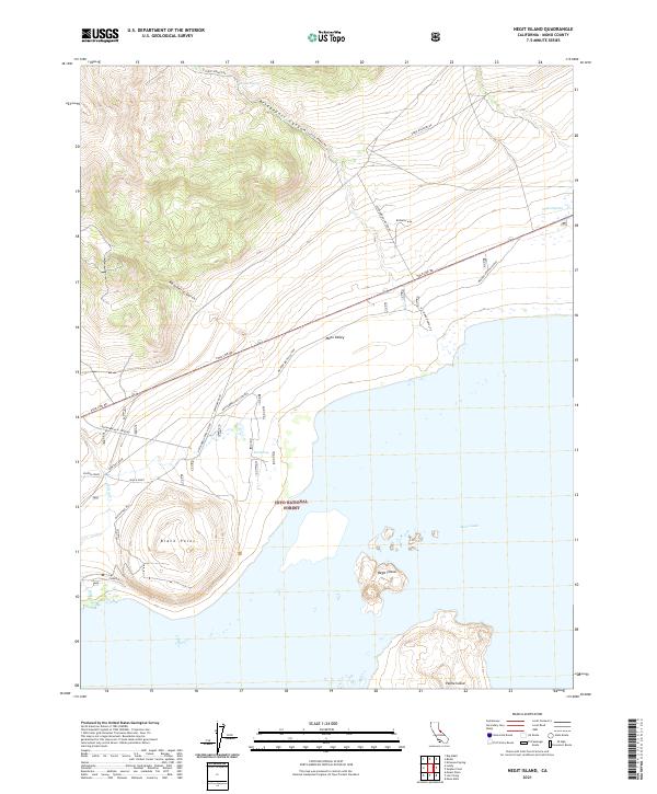
2021 Negit Island
Mono County, CA
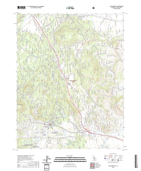
2021 Old Mammoth
Mono County, CA
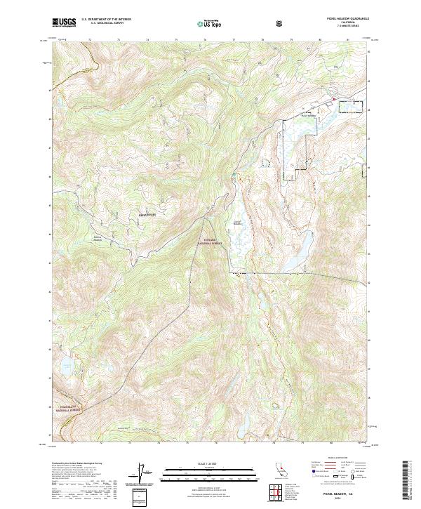
2021 Pickel Meadow
Mono County, CA
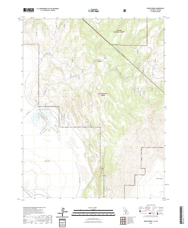
2021 River Spring
Mono County, CA
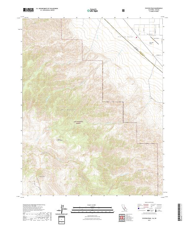
2021 Station Peak
Mono County, CA
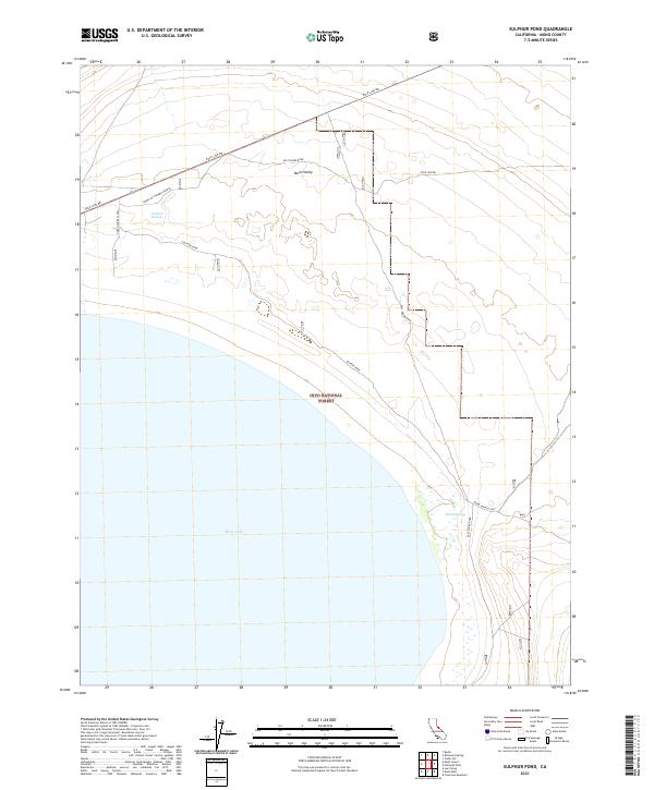
2021 Sulphur Pond
Mono County, CA
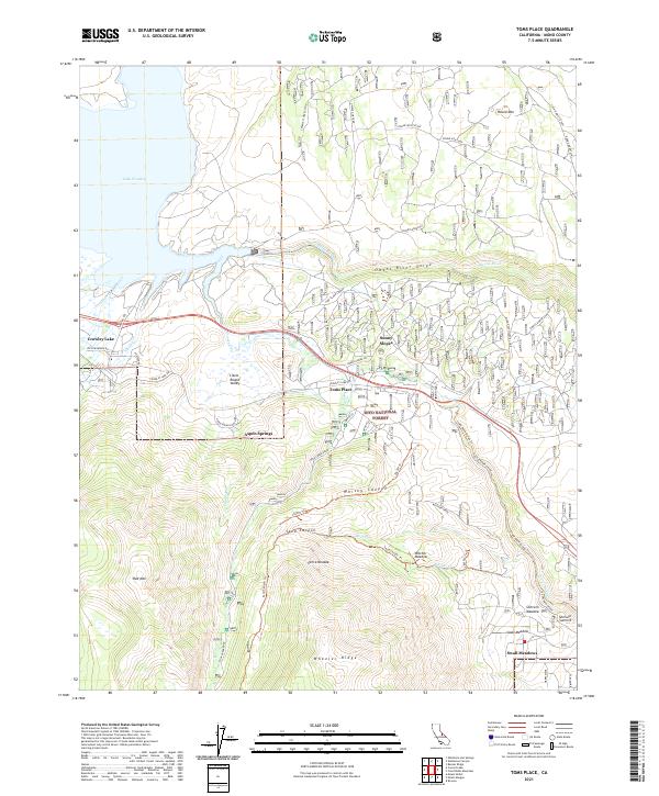
2021 Toms Place
Mono County, CA
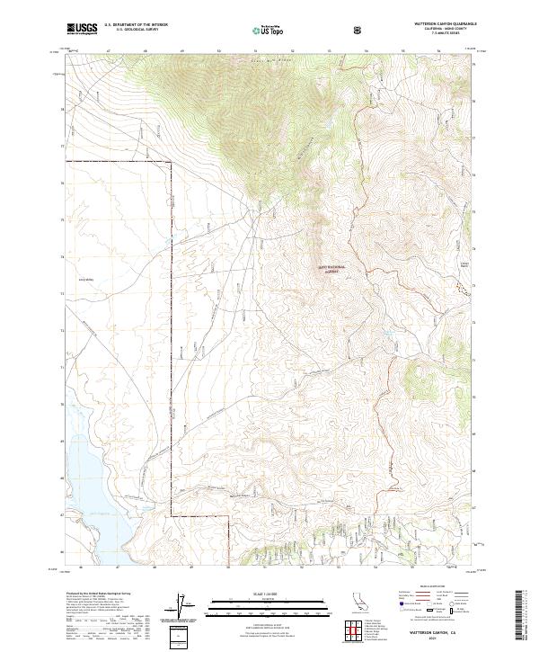
2021 Watterson Canyon
Mono County, CA
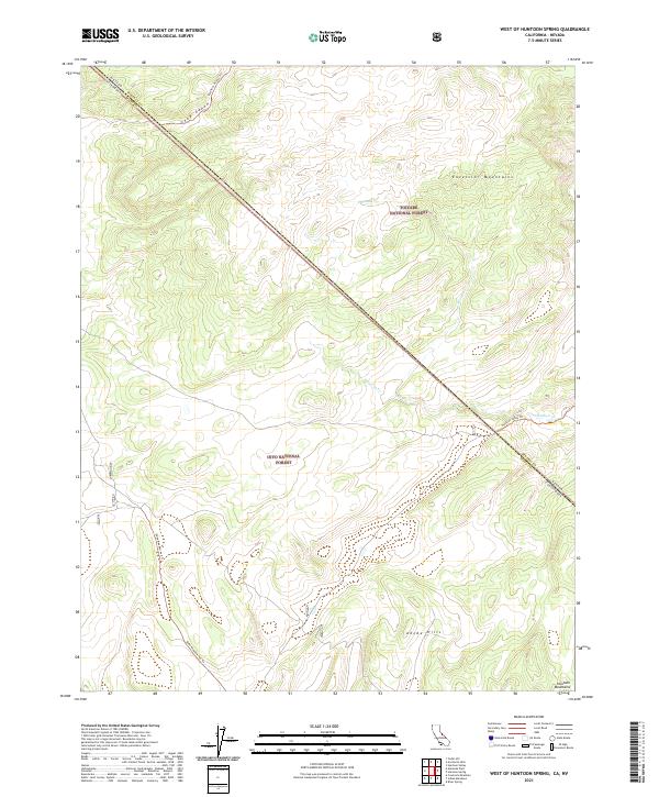
2021 West of Huntoon Spring
Mono County, CA
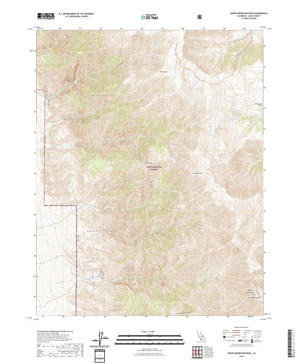
2021 White Mountain Peak
Mono County, CA
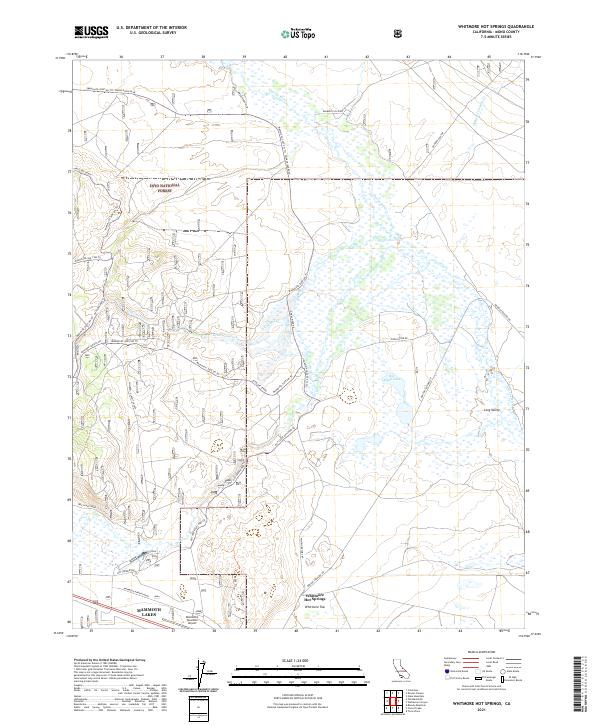
2021 Whitmore Hot Springs
Mono County, CA
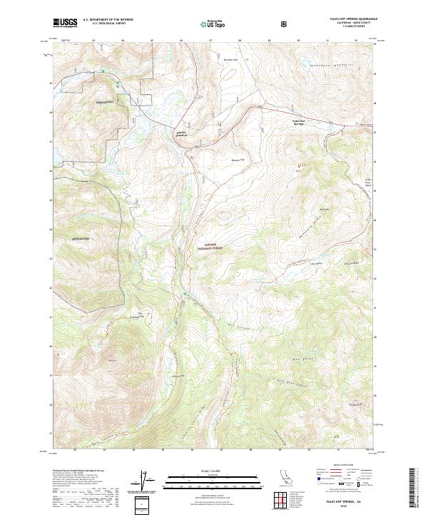
2022 Fales Hot Springs
Mono County, CA
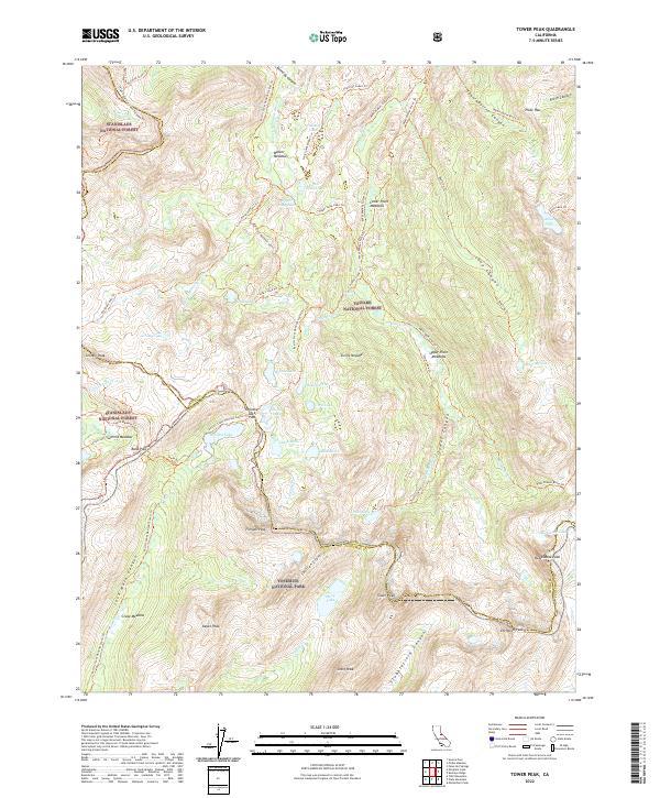
2022 Tower Peak
Mono County, CA