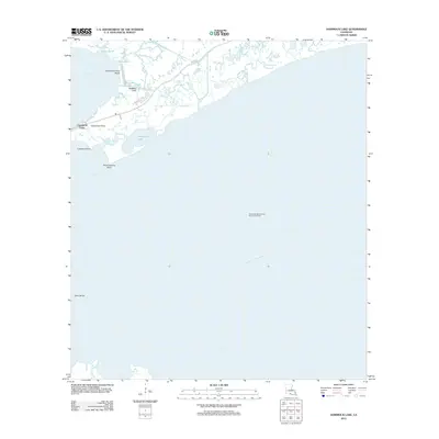
2012 Map of Hammock Lake
USGS Topo · Published 2012About this map
Cypremort Point serves as the focal point of this coastal landscape, situated where the Louisiana marshlands meet the expanse of Vermilion Bay. This 2012 survey documents a delicate geography of points and bayous, featuring the Cypremort Point State Park and the man-made industrial imprint of the Quintana Canal. The coastal economy is evident in the presence of the West Cote Blanche Bay Oil and Gas Field, which occupies the submerged landscape to the south.
Find a feature on this map
20 named features on this map. Tap any name to fly to it.
Don’t see what you’re looking for? This feature index may not catch every label — zoom into the map to look around manually.
Map Details
Editions of this 2012 Hammock Lake Map
This is the sole edition of this map. No revisions or reprints were ever made.
Other maps of this area

1932 · Bayou Blanc
USGS Topo · 1:31,680

1937 · Bayou Sale
USGS Topo · 1:62,500

1937 · Jeanerette
USGS Topo · 1:62,500

1937 · Derouen
USGS Topo · 1:62,500

1945 · New Orleans
USGS Topo · 1:250,000
1948 · Bayou Blanc
USGS Topo · 1:24,000

1948 · Cypremort Point
USGS Topo · 1:24,000

1949 · Cypremort Pt
USGS Topo · 1:31,680

1949 · Bayou Lucien
USGS Topo · 1:31,680
1951 · Lake Point
USGS Topo · 1:24,000