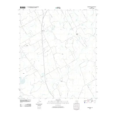
2010 Map of Hammond
USGS Topo · Published 2010About this map
Hammond and the surrounding rural community of Tidwell Prairie anchor this Robertson County landscape, characterized by a dense network of country roads named for local families. The geography is defined by the winding paths of Walnut Creek and Big Willow Creek, which drain a region of subtle topography. Significant local landmarks include Bethlehem Cemetery, Cotton Cemetery, and Saint Paul Cemetery, which serve as vital points of reference for genealogical research. Water management is evident along the smaller tributaries, where Hall Dam contains the waters of Hall Lake. To the west, the settlement of Salter sits near Robertson Lake, while the road network—including names like Bartkowiak Rd, Yezak Rd, and Hopcus Rd—reflects the generational heritage and landownership patterns of this Central Texas farming and ranching area.
Find a feature on this map
50 named features on this map. Tap any name to fly to it.
Don’t see what you’re looking for? This feature index may not catch every label — zoom into the map to look around manually.
Map Details
Editions of this 2010 Hammond Map
This is the sole edition of this map. No revisions or reprints were ever made.
Other maps of this area

1954 · Waco
USGS Topo · 1:250,000

1954 · Austin
USGS Topo · 1:250,000

1955 · Waco
USGS Topo · 1:250,000

1961 · Hearne North
USGS Topo · 1:24,000

1961 · Baileyville
USGS Topo · 1:24,000

1962 · Calvert
USGS Topo · 1:24,000

1962 · Maysfield
USGS Topo · 1:24,000

1962 · Hammond
USGS Topo · 1:24,000

1962 · Reagan
USGS Topo · 1:24,000

1962 · Bremond
USGS Topo · 1:24,000