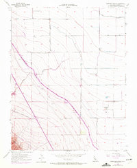
1956 Map of Hammonds Ranch
USGS Topo · Published 1972About this map
The Panoche Hills rise out of the western San Joaquin Valley, creating a landscape defined by industrial water infrastructure and agricultural boundaries. This mid-century survey captures the region as the modern water-delivery system was being integrated into the existing ranchland. The California Aqueduct carves through the terrain, cutting across older survey lines like Shields Ave and Herndon Ave. The intersection of heavy industry and rural life is evident where the Third Lift Canal services the flats north of Hammonds Ranch. Local landmarks such as the Oro Loma School and a Gravel Pit near Little Panoche Creek provide specific points of interest for those tracing the development of Fresno County's interior during a period of significant hydrological engineering.
Find a feature on this map
18 named features on this map. Tap any name to fly to it.
Don’t see what you’re looking for? This feature index may not catch every label — zoom into the map to look around manually.
Map Details
Editions of this 1956 Hammonds Ranch Map
4 editions found
Other maps of this area

1913 · Panoche
USGS Topo · 1:125,000

1921 · Laguna Seca Ranch
USGS Topo · 1:31,680

1921 · Tierra Loma School
USGS Topo · 1:31,680

1922 · Oxalis
USGS Topo · 1:31,680

1922 · Charleston School
USGS Topo · 1:31,680

1922 · Dos Palos
USGS Topo · 1:31,680

1922 · Chaney Ranch
USGS Topo · 1:31,680

1923 · Laguna Seca Ranch
USGS Topo · 1:31,680

1923 · Wisdom Well
USGS Topo · 1:31,680

1923 · Tierra Loma School
USGS Topo · 1:31,680