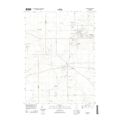
2015 Map of Hampshire
USGS Topo · Published 2015About this map
Hampshire and Burlington anchor this mid-2010s survey of the agricultural and residential landscape spanning the boundary of DeKalb and Kane Counties. The map reveals a transition between rural farmsteads and growing village centers, with established residential streets like E Washington Ave and Industrial Dr showing the community's modern footprint. This area is particularly rich in genealogical sites, featuring several small burial grounds such as the Ward Family Cem and Union Cem. The presence of the Aero Lake Estates Airport near New Lebanon highlights the integration of private aviation within this prairie landscape. The drainage of Coon Cr meanders through the western half of the quadrangle, illustrating the natural watercourses that shaped early settlement patterns before the modern road grid of Allen Rd and Plank Rd became dominant.
Find a feature on this map
86 named features on this map. Tap any name to fly to it.
Don’t see what you’re looking for? This feature index may not catch every label — zoom into the map to look around manually.
Map Details
Editions of this 2015 Hampshire Map
This is the sole edition of this map. No revisions or reprints were ever made.
Other maps of this area

1925 · Elgin
USGS Topo · 1:62,500

1932 · Geneva
USGS Topo · 1:62,500

1937 · Sycamore
USGS Topo · 1:62,500

1938 · Genoa
USGS Topo · 1:62,500

1940 · Elgin
USGS Topo · 1:62,500

1948 · Geneva
USGS Topo · 1:62,500

1954 · Rockford
USGS Topo · 1:250,000

1955 · Rockford
USGS Topo · 1:250,000

1958 · Aurora
USGS Topo · 1:250,000

1958 · Rockford
USGS Topo · 1:250,000