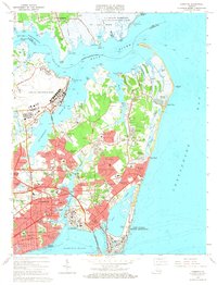
1965 Map of Hampton
USGS Topo · Published 1967About this map
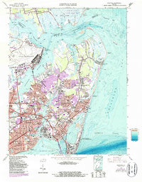
Hampton Roads and the Chesapeake Bay define the geography of this mid-1960s coastal survey, where the historic fortifications of Fort Monroe and Old Point Comfort anchor the southern tip of the peninsula. The map reveals a landscape heavily shaped by military and aerospace presence, dominated by Langley Air Force Base and the Plum Tree Island Bombing Range. Between these installations, rapid mid-century suburban expansion is evident in the dense residential plattings of Sinclair Farms, Riverdale, and Buckroe Gardens. Along the eastern shore, recreational and maritime life centers on Buckroe Beach and the Salt Ponds. The map also documents the critical transportation infrastructure of the era, including the Hampton Tunnel (Toll) Bridge and the Chesapeake and Ohio rail lines, alongside educational landmarks like the Hampton Institute and Kecoughtan High Sch.
Find a feature on this map
114 named features on this map. Tap any name to fly to it.
Don’t see what you’re looking for? This feature index may not catch every label — zoom into the map to look around manually.
Map Details
Editions of this 1965 Hampton Map
5 editions found
Other maps of this area

1907 · Norfolk
USGS Topo · 1:125,000

1907 · Hampton
USGS Topo · 1:62,500

1918 · Cape Henry
USGS Topo · 1:62,500

1919 · Cape Henry
USGS Topo · 1:62,500

1921 · Newport News
USGS Topo · 1:62,500

1943 · Richmond
USGS Topo · 1:250,000

1944 · Hampton
USGS Topo · 1:24,000

1944 · Messick
USGS Topo · 1:24,000

1944 · Morrison
USGS Topo · 1:24,000

1944 · Harris Grove
USGS Topo · 1:24,000