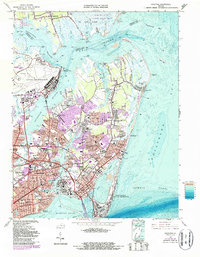
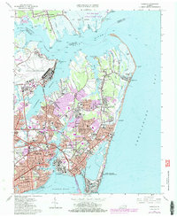
1965 Map of Hampton
USGS Topo · Published 1987About this map
The coastal defense and aviation heritage of the Virginia Peninsula are centered here, where Fort Monroe and Langley Air Force Base dominate the strategic landscape. This 1960s-era topography reveals a dense urban expansion from the historic center of Hampton toward the salt marshes of Plum Tree Island. The map records the integration of military, academic, and residential life, notably at the Hampton Institute and surrounding neighborhoods like Merrimac Shores and Pleasant Manor.
Find a feature on this map
112 named features on this map. Tap any name to fly to it.
Don’t see what you’re looking for? This feature index may not catch every label — zoom into the map to look around manually.
Map Details
Editions of this 1965 Hampton Map
5 editions found
Other maps of this area

1907 · Norfolk
USGS Topo · 1:125,000

1907 · Hampton
USGS Topo · 1:62,500

1918 · Cape Henry
USGS Topo · 1:62,500

1919 · Cape Henry
USGS Topo · 1:62,500

1921 · Newport News
USGS Topo · 1:62,500

1943 · Richmond
USGS Topo · 1:250,000

1944 · Hampton
USGS Topo · 1:24,000

1944 · Messick
USGS Topo · 1:24,000

1944 · Morrison
USGS Topo · 1:24,000

1944 · Harris Grove
USGS Topo · 1:24,000