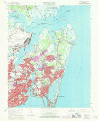
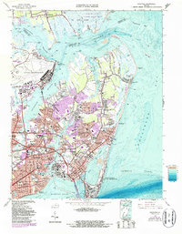
1965 Map of Hampton
USGS Topo · Published 1971About this map
The historic harbor of Hampton Roads and the strategic peninsula of Old Point Comfort anchor this coastal Virginia survey. The landscape is defined by its deep military roots, featuring the detailed layout of Fort Monroe and the sprawling runways of Langley Air Force Base. Education and community growth are evident in the presence of Hampton Institute and numerous mid-century neighborhoods such as Riverdale, Sinclair Farms, and Buckroe Gardens. Along the Chesapeake Bay, the resort character of Buckroe Beach is visible near the Salt Ponds. To the north, the terrain transitions into the tidal marshes of the Plum Tree Island Bombing Range and the Big Salt Marsh, illustrating the area's dual identity as a naval-industrial hub and an ecologically complex coastal environment. Small maritime landmarks like Amorys Wharf and a Lighthouse (Aban'd) at Grand View hint at older Chesapeake traditions.
Find a feature on this map
138 named features on this map. Tap any name to fly to it.
Don’t see what you’re looking for? This feature index may not catch every label — zoom into the map to look around manually.
Map Details
Editions of this 1965 Hampton Map
5 editions found
Other maps of this area

1907 · Norfolk
USGS Topo · 1:125,000

1907 · Hampton
USGS Topo · 1:62,500

1918 · Cape Henry
USGS Topo · 1:62,500

1919 · Cape Henry
USGS Topo · 1:62,500

1921 · Newport News
USGS Topo · 1:62,500

1943 · Richmond
USGS Topo · 1:250,000

1944 · Hampton
USGS Topo · 1:24,000

1944 · Messick
USGS Topo · 1:24,000

1944 · Morrison
USGS Topo · 1:24,000

1944 · Harris Grove
USGS Topo · 1:24,000