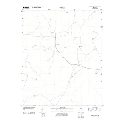
2010 Map of Hampton Ranch
USGS Topo · Published 2010About this map
Bryantine Cemetery sits at the heart of this high-plains landscape, serving as a primary point of historical interest in a region defined by ranching and water scarcity. The terrain is marked by intermittent watercourses like Carros Creek, Conejo Creek, and Wynn Creek, which dictate the placement of small settlements and camps. These drainages converge toward the Romero Draw and the Gravel Hills to the north, creating a network of seasonal hydrology essential for local survival.
Find a feature on this map
26 named features on this map. Tap any name to fly to it.
Don’t see what you’re looking for? This feature index may not catch every label — zoom into the map to look around manually.
Map Details
Editions of this 2010 Hampton Ranch Map
This is the sole edition of this map. No revisions or reprints were ever made.
Other maps of this area

1930 · Tucumcari
USGS Topo · 1:125,000

1954 · Tucumcari
USGS Topo · 1:250,000

1958 · Tucumcari
USGS Topo · 1:250,000

1967 · Trinchera Creek
USGS Topo · 1:24,000

1968 · Bascom Camp
USGS Topo · 1:24,000

1968 · Hampton Ranch
USGS Topo · 1:24,000

1968 · Hudson
USGS Topo · 1:24,000

1968 · Montesito Creek
USGS Topo · 1:24,000
1968 · Medina Mesa
USGS Topo · 1:24,000

1969 · Gallegos
USGS Topo · 1:24,000