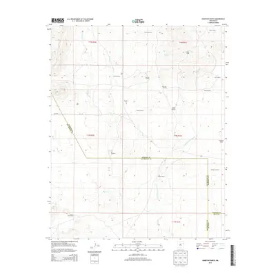
2013 Map of Hampton Ranch
USGS Topo · Published 2013About this map
Bryantine Cem serves as a small but significant historical marker in this ranching landscape where San Miguel, Harding, and Quay counties meet. The high plains terrain is defined by a sophisticated network of water management, illustrated by numerous family-named landmarks such as the John Pool Windmill, Oscar Pool Windmill, and Bailey Windmill. These features, along with the Hampton Ranch and McCuistion Camp, indicate the long-standing cattle-raising economy of this territory.
Find a feature on this map
36 named features on this map. Tap any name to fly to it.
Don’t see what you’re looking for? This feature index may not catch every label — zoom into the map to look around manually.
Map Details
Editions of this 2013 Hampton Ranch Map
This is the sole edition of this map. No revisions or reprints were ever made.
Other maps of this area

1930 · Tucumcari
USGS Topo · 1:125,000

1954 · Tucumcari
USGS Topo · 1:250,000

1958 · Tucumcari
USGS Topo · 1:250,000

1967 · Trinchera Creek
USGS Topo · 1:24,000

1968 · Bascom Camp
USGS Topo · 1:24,000

1968 · Hampton Ranch
USGS Topo · 1:24,000

1968 · Hudson
USGS Topo · 1:24,000

1968 · Montesito Creek
USGS Topo · 1:24,000
1968 · Medina Mesa
USGS Topo · 1:24,000

1969 · Gallegos
USGS Topo · 1:24,000