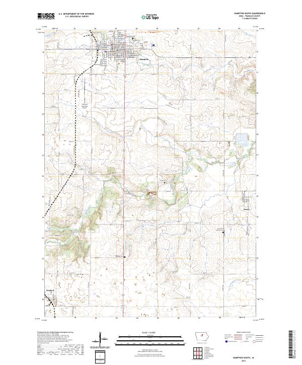
2023 Map of Hampton South
USGS Topo · Published 2023About this map
The Franklin County Courthouse stands as the central landmark of Hampton, where a detailed street grid including 1st Ave NW and S Federal St reflects the community's organized growth. This central Iowa landscape is defined by the winding paths of Maynes Creek and Beeds Creek, which carve through the agricultural tablelands south toward Bradford and east toward Geneva.
Find a feature on this map
56 named features on this map. Tap any name to fly to it.
Don’t see what you’re looking for? This feature index may not catch every label — zoom into the map to look around manually.
Map Details
Editions of this 2023 Hampton South Map
This is the sole edition of this map. No revisions or reprints were ever made.
Other maps of this area

1954 · Waterloo
USGS Topo · 1:250,000

1955 · Waterloo
USGS Topo · 1:250,000

1972 · Hansell
USGS Topo · 1:24,000

1972 · Latimer
USGS Topo · 1:24,000

1972 · Hampton North
USGS Topo · 1:24,000

1979 · Ackley NE
USGS Topo · 1:24,000

1979 · Coulter
USGS Topo · 1:24,000

1979 · Iowa Falls West
USGS Topo · 1:24,000

1979 · Ackley
USGS Topo · 1:24,000

1979 · Iowa Falls East
USGS Topo · 1:24,000