
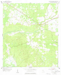
1954 Map of Hampton Springs
USGS Topo · Published 1955About this map
Hampton Springs sits at the center of this Taylor County landscape, where the Fenholloway River and Rocky Creek converge amidst a complex network of wetlands and wooded hammocks. The 1954 survey reveals an economy transitioning from timber and rail to resource extraction, evidenced by the presence of a Borrow Pit, Gravel Pit, and Sand Pit. An Old Railroad Grade snakes through the northern sections, marking the path of former industrial transport near the low-lying Thomas Mill Hammock.
Find a feature on this map
12 named features on this map. Tap any name to fly to it.
Don’t see what you’re looking for? This feature index may not catch every label — zoom into the map to look around manually.
Map Details
Editions of this 1954 Hampton Springs Map
3 editions found
Other maps of this area

1952 · Secotan
USGS Topo · 1:24,000

1954 · Johnson Hammock
USGS Topo · 1:24,000

1954 · Warrior Swamp
USGS Topo · 1:24,000

1954 · Boyd
USGS Topo · 1:24,000

1954 · Secotan
USGS Topo · 1:24,000

1954 · Okefenokee Slough
USGS Topo · 1:24,000

1954 · Gainesville
USGS Topo · 1:250,000

1954 · Valdosta
USGS Topo · 1:250,000

1955 · Perry
USGS Topo · 1:24,000

1955 · Rock Islands
USGS Topo · 1:24,000