
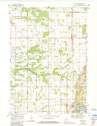
1968 Map of Hancock
USGS Topo · Published 1971About this map
Plainfield and Hancock anchor this late-1960s landscape, where the agricultural grid of Central Wisconsin is defined by an extensive network of named rural roads like Akron Avenue and Apache Lane. This area, situated at the intersection of Portage, Adams, and Waushara counties, reveals a transition from the structured farm plots of the Leola and Plainfield townships to the more varied terrain around Big Roche a Cri Creek.
Find a feature on this map
39 named features on this map. Tap any name to fly to it.
Don’t see what you’re looking for? This feature index may not catch every label — zoom into the map to look around manually.
Map Details
Editions of this 1968 Hancock Map
2 editions found
Other maps of this area

1955 · Green Bay
USGS Topo · 1:250,000

1957 · Amherst
USGS Topo · 1:48,000

1957 · Whiting
USGS Topo · 1:48,000

1958 · Coloma
USGS Topo · 1:48,000

1959 · Wautoma
USGS Topo · 1:48,000

1968 · Coloma NW
USGS Topo · 1:24,000

1968 · Coloma SW
USGS Topo · 1:24,000

1968 · Coloma
USGS Topo · 1:24,000

1968 · Richford
USGS Topo · 1:24,000

1968 · Plainfield
USGS Topo · 1:24,000