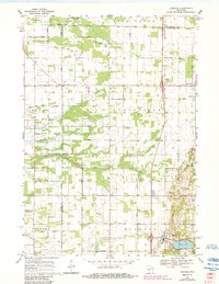
1968 Map of Hancock
USGS Topo · Published 1984About this map
The village of Hancock serves as the focal point of this Central Wisconsin landscape, where the convergence of Adams, Waushara, and Portage counties defines local boundaries. This 1960s survey illustrates a region shaped by agricultural geometry and conservation, notably the Big Roche a Cri State Fishery Area along the winding Big Roche a Cri Creek. The land is dotted with specialized infrastructure including a Fish Hatchery, a Water Tank, and several irrigation wells, reflecting the area's intensive land use.
Find a feature on this map
44 named features on this map. Tap any name to fly to it.
Don’t see what you’re looking for? This feature index may not catch every label — zoom into the map to look around manually.
Map Details
Editions of this 1968 Hancock Map
2 editions found

Other maps of this area

1955 · Green Bay
USGS Topo · 1:250,000

1957 · Amherst
USGS Topo · 1:48,000

1957 · Whiting
USGS Topo · 1:48,000

1958 · Coloma
USGS Topo · 1:48,000

1959 · Wautoma
USGS Topo · 1:48,000

1968 · Coloma NW
USGS Topo · 1:24,000

1968 · Coloma SW
USGS Topo · 1:24,000

1968 · Coloma
USGS Topo · 1:24,000

1968 · Richford
USGS Topo · 1:24,000

1968 · Plainfield
USGS Topo · 1:24,000