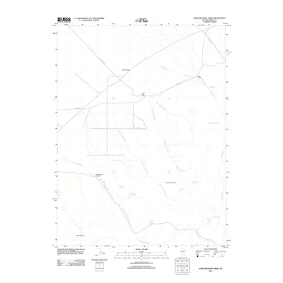
2012 Map of Hand-me-down Creek
USGS Topo · Published 2012About this map
Crescent Valley and the Cortez Mountains define the high desert landscape of Eureka County in this early 21st-century record. The map reveals a remote ranching environment where life revolves around isolated water sources and long-established landholdings like the Dewey Dann Ranch and Duff Ranch. The hydrography of the region is notably detailed, featuring a complex network of seasonal flows and named springs such as Florio Spring Number Six, Twenty One Spring, and Summit Spring. These vital points of water illustrate the challenges of land use in a region where Cottonwood Creek and Hand-me-down Creek carve through the basin and range. Significant local topography is documented at Cottonwood Canyon and Brock Canyon, while the sparse road network is represented by routes like Danna Rd and Dean-Dann-Spa, providing a clear picture of the area's rural infrastructure.
Find a feature on this map
23 named features on this map. Tap any name to fly to it.
Don’t see what you’re looking for? This feature index may not catch every label — zoom into the map to look around manually.
Map Details
Editions of this 2012 Hand-me-down Creek Map
This is the sole edition of this map. No revisions or reprints were ever made.
Other maps of this area

1938 · Cortez
USGS Topo · 1:48,000

1944 · Cortez
USGS Topo · 1:62,500

1949 · Crescent Valley
USGS Topo · 1:62,500

1950 · Crescent Valley
USGS Topo · 1:62,500

1955 · Winnemucca
USGS Topo · 1:250,000

1957 · Frenchie Creek
USGS Topo · 1:62,500

1957 · Horse Creek Valley
USGS Topo · 1:62,500

1958 · Winnemucca
USGS Topo · 1:250,000

1962 · Winnemucca
USGS Topo · 1:250,000
1985 · Thatcher Spring
USGS Topo · 1:24,000