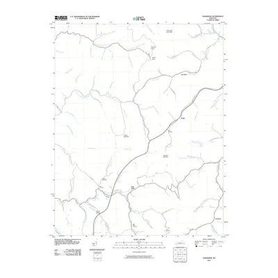
2010 Map of Handshoe
USGS Topo · Published 2010About this map
Soft Shell and Handshoe anchor this corner of the Kentucky highlands, where the topography is defined by the deep dissection of Middle Fork Quicksand Creek and its countless tributaries. The map reveals a landscape of high ridges and narrow hollows, such as Shanty Hollow, which have long dictated the pattern of local settlement. High points like Yellow Mountain and Chestnut Mountain rise above the valleys, while the Signal Knob Lookout Tower serves as a prominent landmark atop the terrain. For those researching family history in the region, the placement of the Bolen Cemetery, Estill Smith Cemetery, and Click Cemetery provides specific geographic anchors for local lineages. The network of winding mountain roads, including Signal Knob Rd and Rock Fork Rd, follows the natural contours of the creeks, illustrating the enduring relationship between the geography of the Cumberland Plateau and its transportation corridors.
Find a feature on this map
75 named features on this map. Tap any name to fly to it.
Don’t see what you’re looking for? This feature index may not catch every label — zoom into the map to look around manually.
Map Details
Editions of this 2010 Handshoe Map
This is the sole edition of this map. No revisions or reprints were ever made.
Other maps of this area

1886 · Prestonsburg
USGS Topo · 1:125,000

1889 · Salyersville
USGS Topo · 1:125,000

1890 · Whitesburg
USGS Topo · 1:125,000

1891 · Hazard
USGS Topo · 1:125,000

1891 · Salyersville
USGS Topo · 1:125,000

1892 · Whitesburg
USGS Topo · 1:125,000

1892 · Prestonsburg
USGS Topo · 1:125,000

1899 · Salyersville
USGS Topo · 1:125,000

1912 · Hindman
USGS Topo · 1:48,000

1914 · Troublesome
USGS Topo · 1:62,500