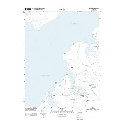
2011 Map of Hanesville
USGS Topo · Published 2011About this map
Chesapeake Landing and Hanesville anchor this 2011 perspective of the Kent County shoreline, where the intricate geography of the Eastern Shore meets the Chesapeake Bay. The map reveals a landscape defined by its relation to the water, from the maritime activity at Green Point Marina and Gales Wharf to the residential pockets of Worton Heights and Newtown. Agricultural roots remain visible in family-named properties like Churn Creek Farm and small crossroads such as Diehls Cross Roads.
Find a feature on this map
68 named features on this map. Tap any name to fly to it.
Don’t see what you’re looking for? This feature index may not catch every label — zoom into the map to look around manually.
Map Details
Editions of this 2011 Hanesville Map
This is the sole edition of this map. No revisions or reprints were ever made.
Other maps of this area

1893 · North Point
USGS Topo · 1:62,500

1893 · Gunpowder
USGS Topo · 1:62,500

1898 · Tolchester
USGS Topo · 1:125,000

1900 · Betterton
USGS Topo · 1:62,500

1901 · Chestertown
USGS Topo · 1:62,500

1901 · Gunpowder
USGS Topo · 1:62,500

1903 · Tolchester
USGS Topo · 1:125,000

1904 · North Point
USGS Topo · 1:62,500

1908 · Tolchester
USGS Topo · 1:125,000

1920 · Chestertown
USGS Topo · 1:62,500