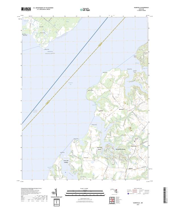
2023 Map of Hanesville
USGS Topo · Published 2023About this map
Fairlee Neck and the surrounding Kent County countryside define this 2023 landscape, where the Eastern Shore meets the Chesapeake Bay. The map documents a residential and agricultural pattern marked by small, waterfront-oriented communities such as Chesapeake Landing and Great Oak Manor. The maritime history of the area is evident in the numerous coves and points, including Worton Point and the Intracostal Waterway which cuts through the bay. Inland, the settlement of Hanesville serves as a local hub near Saint James Methodist Cem, illustrating the enduring nature of local burial grounds and community centers. The network of winding local roads like Saint James Newtown Rd and Buck Neck Rd connect these established landings to the larger farms and woodlots that characterize this part of Maryland's tidewater region.
Find a feature on this map
75 named features on this map. Tap any name to fly to it.
Don’t see what you’re looking for? This feature index may not catch every label — zoom into the map to look around manually.
Map Details
Editions of this 2023 Hanesville Map
This is the sole edition of this map. No revisions or reprints were ever made.
Other maps of this area

1893 · North Point
USGS Topo · 1:62,500

1893 · Gunpowder
USGS Topo · 1:62,500

1898 · Tolchester
USGS Topo · 1:125,000

1900 · Betterton
USGS Topo · 1:62,500

1901 · Chestertown
USGS Topo · 1:62,500

1901 · Gunpowder
USGS Topo · 1:62,500

1903 · Tolchester
USGS Topo · 1:125,000

1904 · North Point
USGS Topo · 1:62,500

1908 · Tolchester
USGS Topo · 1:125,000

1920 · Chestertown
USGS Topo · 1:62,500