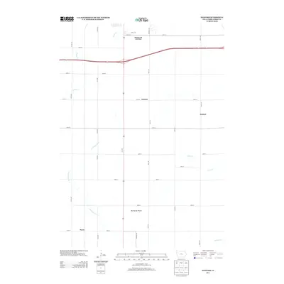
2013 Map of Hanford
USGS Topo · Published 2013About this map
Blazing Star Prairie remains a notable natural preserve in this section of Cerro Gordo County, surrounded by a grid of agricultural land and small rural hubs. The landscape is defined by the headwaters and tributaries of several drainage systems, including Mason Cr and Cheslea Cr, which flow through the northern reaches of the quadrangle. Transport infrastructure is dominated by the intersection of major routes at Mason City Junction, a critical point where regional highways meet east of Hurley. The small settlements of Hanford and Cameron appear as quiet junctions along the local road network, which follows a strict section-line layout including Quail Ave and 220th St. To the south and east, the winding paths of Beaver Cr and E Br Beaverdam Cr create the only breaks in the geometric pattern of the Iowa farmland, illustrating the persistent influence of hydrology on the development of this prairie region.
Find a feature on this map
31 named features on this map. Tap any name to fly to it.
Don’t see what you’re looking for? This feature index may not catch every label — zoom into the map to look around manually.
Map Details
Editions of this 2013 Hanford Map
This is the sole edition of this map. No revisions or reprints were ever made.
Other maps of this area

1954 · Mason City
USGS Topo · 1:250,000

1954 · Waterloo
USGS Topo · 1:250,000

1955 · Waterloo
USGS Topo · 1:250,000

1957 · Mason City
USGS Topo · 1:250,000

1958 · Mason City
USGS Topo · 1:250,000

1959 · Mason City
USGS Topo · 1:24,000

1959 · Mason City
USGS Topo · 1:62,500

1959 · Nora Springs
USGS Topo · 1:24,000

1959 · Mason City SE
USGS Topo · 1:24,000

1959 · Hanford
USGS Topo · 1:24,000