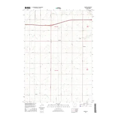
2015 Map of Hanford
USGS Topo · Published 2015About this map
Agricultural patterns and a rigid section-line road network define this portion of Cerro Gordo County south of Mason City. Small settlements like Portland and Hanford serve as anchors within a landscape dominated by drainage features and modest water bodies. Notable among these are Clark Lake and Lake Fin- Feather, which provide small aquatic breaks in the upland plains. The terrain is dissected by several waterways, including Cheslea Cr and Mason Cr in the north, while the southern reaches are marked by the E Br Beaverdam Cr and Coldwater Cr. A distinct topographic feature, the Big Gully, cuts through the eastern sections near the junction of Raven Ave and 220th St, illustrating the local drainage patterns that have influenced rural development and farm placement in this region.
Find a feature on this map
40 named features on this map. Tap any name to fly to it.
Don’t see what you’re looking for? This feature index may not catch every label — zoom into the map to look around manually.
Map Details
Editions of this 2015 Hanford Map
This is the sole edition of this map. No revisions or reprints were ever made.
Other maps of this area

1954 · Mason City
USGS Topo · 1:250,000

1954 · Waterloo
USGS Topo · 1:250,000

1955 · Waterloo
USGS Topo · 1:250,000

1957 · Mason City
USGS Topo · 1:250,000

1958 · Mason City
USGS Topo · 1:250,000

1959 · Mason City
USGS Topo · 1:24,000

1959 · Mason City
USGS Topo · 1:62,500

1959 · Nora Springs
USGS Topo · 1:24,000

1959 · Mason City SE
USGS Topo · 1:24,000

1959 · Hanford
USGS Topo · 1:24,000