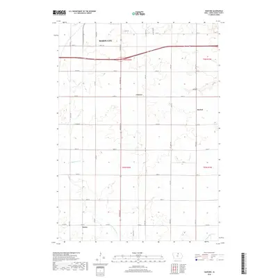
2018 Map of Hanford
USGS Topo · Published 2018About this map
Mason City anchors the northern reaches of this Cerro Gordo County landscape, where the urban grid gives way to an expansive agricultural pattern defined by the Public Land Survey System. The southern outskirts of the city transition into the rural communities of Cameron, Hanford, and Hurley, each situated within a network of section-line roads such as S Federal Ave and Partridge Ave. The terrain is subtly carved by a series of waterways, including Mason Cr, Cheslea Cr, and the branching reaches of E Br Beaverdam Cr. A notable geographic feature, Big Gully, cuts through the eastern sections near the t96n r19w township boundary. This survey illustrates the persistent importance of the 19th-century township-and-range system in shaping contemporary Iowa land use and transportation.
Find a feature on this map
39 named features on this map. Tap any name to fly to it.
Don’t see what you’re looking for? This feature index may not catch every label — zoom into the map to look around manually.
Map Details
Editions of this 2018 Hanford Map
This is the sole edition of this map. No revisions or reprints were ever made.
Other maps of this area

1954 · Mason City
USGS Topo · 1:250,000

1954 · Waterloo
USGS Topo · 1:250,000

1955 · Waterloo
USGS Topo · 1:250,000

1957 · Mason City
USGS Topo · 1:250,000

1958 · Mason City
USGS Topo · 1:250,000

1959 · Mason City
USGS Topo · 1:24,000

1959 · Mason City
USGS Topo · 1:62,500

1959 · Nora Springs
USGS Topo · 1:24,000

1959 · Mason City SE
USGS Topo · 1:24,000

1959 · Hanford
USGS Topo · 1:24,000