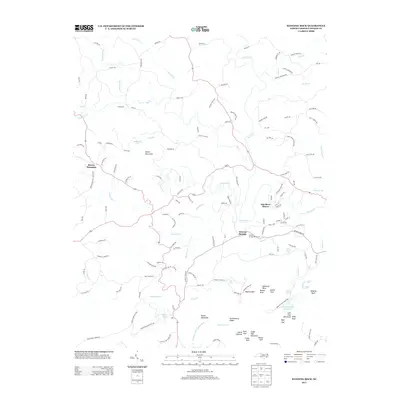
2013 Map of Hanging Rock
USGS Topo · Published 2013About this map
Hanging Rock State Park anchors this terrain in Stokes County, where the easternmost peaks of the Sauratown Mountains rise sharply above the Dan River. The geography is defined by prominent quartzite formations, including the iconic Hanging Rock, Moores Knob, and Balanced Rock. Water is a central theme of this 2013 survey, featuring numerous cascades like Window Falls, Hidden Falls, and Lower Cascade Falls. Historical land use is evident in the transition from the Mineral Springs Resort Area near Moores Springs to the residential development of Dan River Shores. Local genealogy and land history are reflected in family-named thoroughfares such as Piney Grove Church Rd, Ellis Lawson Rd, and Zeb Mabe Rd, which trace the patterns of long-established community life between the river and the mountain ridges of Sauratown Mountain.
Find a feature on this map
149 named features on this map. Tap any name to fly to it.
Don’t see what you’re looking for? This feature index may not catch every label — zoom into the map to look around manually.
Map Details
Editions of this 2013 Hanging Rock Map
This is the sole edition of this map. No revisions or reprints were ever made.
Other maps of this area

1926 · Critz
USGS Topo · 1:48,000

1928 · Stuart
USGS Topo · 1:48,000

1928 · Critz
USGS Topo · 1:62,500

1931 · Stuart
USGS Topo · 1:62,500

1953 · Winston-Salem
USGS Topo · 1:250,000

1955 · Winston-Salem
USGS Topo · 1:250,000

1962 · Winston-Salem
USGS Topo · 1:250,000

1964 · Hanging Rock
USGS Topo · 1:24,000

1964 · Pinnacle
USGS Topo · 1:24,000

1964 · King
USGS Topo · 1:24,000