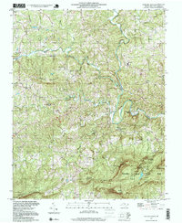
1997 Map of Hanging Rock
USGS Topo · Published 1999About this map
Hanging Rock State Park anchors the southern portion of this landscape, where the dramatic elevations of the Sauratown Mountain range meet the winding path of the Dan River. The terrain is defined by prominent peaks and ridges, including Brown Mountain, Ruben Mountain, and Moores Knob. A network of cataracts, including Cascade Falls, Window Falls, and Hidden Falls, highlights the steep vertical drops of the watershed.
Find a feature on this map
49 named features on this map. Tap any name to fly to it.
Don’t see what you’re looking for? This feature index may not catch every label — zoom into the map to look around manually.
Map Details
Editions of this 1997 Hanging Rock Map
This is the sole edition of this map. No revisions or reprints were ever made.
Other maps of this area

1926 · Critz
USGS Topo · 1:48,000

1928 · Stuart
USGS Topo · 1:48,000

1928 · Critz
USGS Topo · 1:62,500

1931 · Stuart
USGS Topo · 1:62,500

1953 · Winston-Salem
USGS Topo · 1:250,000

1955 · Winston-Salem
USGS Topo · 1:250,000

1962 · Winston-Salem
USGS Topo · 1:250,000

1964 · Hanging Rock
USGS Topo · 1:24,000

1964 · Pinnacle
USGS Topo · 1:24,000

1964 · King
USGS Topo · 1:24,000