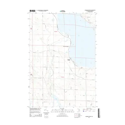
2014 Map of Hangore Heights
USGS Topo · Published 2014About this map
Black Lake and its western shoreline define this portion of Cheboygan County, where the Black River flows through a series of wetland systems and small basins. The landscape is a network of named water bodies and creeks, including Kleber Pond, Mud Lake, and Fisher Cr, interspersed with a grid of rural roads and section lines. Settlement is concentrated along the lakefront at Pine Grove Beach and Hangore Heights, illustrating the region's character as a site for seasonal and residential lakeside living.
Find a feature on this map
55 named features on this map. Tap any name to fly to it.
Don’t see what you’re looking for? This feature index may not catch every label — zoom into the map to look around manually.
Map Details
Editions of this 2014 Hangore Heights Map
This is the sole edition of this map. No revisions or reprints were ever made.
Other maps of this area

1955 · Cheboygan
USGS Topo · 1:250,000

1957 · Tower
USGS Topo · 1:62,500

1957 · Cheboygan
USGS Topo · 1:62,500

1957 · Onaway
USGS Topo · 1:62,500

1958 · Cheboygan
USGS Topo · 1:250,000

1958 · Grace
USGS Topo · 1:62,500

1982 · Petoskey
USGS Topo · 1:100,000

1982 · Grace
USGS Topo · 1:24,000

1982 · Aloha
USGS Topo · 1:25,000
1982 · Manning
USGS Topo · 1:25,000